Distortion-Adaptive Grape Bunch Counting for Omnidirectional Images

Ryota Akai, Yuzuko Utsumi, Yuka Miwa, Masakazu Iwamura, Koichi Kise

Responsive image

Auto-TLDR; Object Counting for Omnidirectional Images Using Stereographic Projection

Poster

This paper proposes the first object counting method for omnidirectional images. Because conventional object counting methods cannot handle the distortion of omnidirectional images, we propose to process them using stereographic projection, which enables conventional methods to obtain a good approximation of the density function. However, the images obtained by stereographic projection are still distorted. Hence, to manage this distortion, we propose two methods. One is a new data augmentation method designed for the stereographic projection of omnidirectional images. The other is a distortion-adaptive Gaussian kernel that generates a density map ground truth while taking into account the distortion of stereographic projection. Using the counting of grape bunches as a case study, we constructed an original grape-bunch image dataset consisting of omnidirectional images and conducted experiments to evaluate the proposed method. The results show that the proposed method performs better than a direct application of the conventional method, improving mean absolute error by 14.7% and mean squared error by 10.5%.

Similar papers

Point In: Counting Trees with Weakly Supervised Segmentation Network

Pinmo Tong, Shuhui Bu, Pengcheng Han

Responsive image

Auto-TLDR; Weakly Tree counting using Deep Segmentation Network with Localization and Mask Prediction

Slides Poster Similar

For tree counting tasks, since traditional image processing methods require expensive feature engineering and are not end-to-end frameworks, this will cause additional noise and cannot be optimized overall, so this method has not been widely used in recent trends of tree counting application. Recently, many deep learning based approaches are designed for this task because of the powerful feature extracting ability. The representative way is bounding box based supervised method, but time-consuming annotations are indispensable for them. Moreover, these methods are difficult to overcome the occlusion or overlap. To solve this problem, we propose a weakly tree counting network (WTCNet) based on deep segmentation network with only point supervision. It can simultaneously complete tree counting with localization and output mask of each tree at the same time. We first adopt a novel feature extractor network (FENet) to get features of input images, and then an effective strategy is introduced to deal with different mask predictions. In the end, we propose a basic localization guidance accompany with rectification guidance to train the network. We create two different datasets and select an existing challenging plant dataset to evaluate our method on three different tasks. Experimental results show the good performance improvement of our method compared with other existing methods. Further study shows that our method has great potential to reduce human labor and provide effective ground-truth masks and the results show the superiority of our method over the advanced methods.

Learning Error-Driven Curriculum for Crowd Counting

Wenxi Li, Zhuoqun Cao, Qian Wang, Songjian Chen, Rui Feng

Responsive image

Auto-TLDR; Learning Error-Driven Curriculum for Crowd Counting with TutorNet

Similar

Density regression has been widely employed in crowd counting. However, the frequency imbalance of pixel values in the density map is still an obstacle to improve the performance. In this paper, we propose a novel learning strategy for learning error-driven curriculum, which uses an additional network to supervise the training of the main network. A tutoring network called TutorNet is proposed to repetitively indicate the critical errors of the main network. TutorNet generates pixel-level weights to formulate the curriculum for the main network during training, so that the main network will assign a higher weight to those hard examples than easy examples. Furthermore, we scale the density map by a factor to enlarge the distance among inter-examples, which is well known to improve the performance. Extensive experiments on two challenging benchmark datasets show that our method has achieved state-of-the-art performance.

Encoder-Decoder Based Convolutional Neural Networks with Multi-Scale-Aware Modules for Crowd Counting

Pongpisit Thanasutives, Ken-Ichi Fukui, Masayuki Numao, Boonserm Kijsirikul

Responsive image

Auto-TLDR; M-SFANet and M-SegNet for Crowd Counting Using Multi-Scale Fusion Networks

Slides Poster Similar

In this paper, we proposed two modified neural networks based on dual path multi-scale fusion networks (SFANet) and SegNet for accurate and efficient crowd counting. Inspired by SFANet, the first model, which is named M-SFANet, is attached with atrous spatial pyramid pooling (ASPP) and context-aware module (CAN). The encoder of M-SFANet is enhanced with ASPP containing parallel atrous convolutional layers with different sampling rates and hence able to extract multi-scale features of the target object and incorporate larger context. To further deal with scale variation throughout an input image, we leverage the CAN module which adaptively encodes the scales of the contextual information. The combination yields an effective model for counting in both dense and sparse crowd scenes. Based on the SFANet decoder structure, M-SFANet's decoder has dual paths, for density map and attention map generation. The second model is called M-SegNet, which is produced by replacing the bilinear upsampling in SFANet with max unpooling that is used in SegNet. This change provides a faster model while providing competitive counting performance. Designed for high-speed surveillance applications, M-SegNet has no additional multi-scale-aware module in order to not increase the complexity. Both models are encoder-decoder based architectures and are end-to-end trainable. We conduct extensive experiments on five crowd counting datasets and one vehicle counting dataset to show that these modifications yield algorithms that could improve state-of-the-art crowd counting methods.

VGG-Embedded Adaptive Layer-Normalized Crowd Counting Net with Scale-Shuffling Modules

Dewen Guo, Jie Feng, Bingfeng Zhou
Responsive image

Auto-TLDR; VadaLN: VGG-embedded Adaptive Layer Normalization for Crowd Counting

Slides Poster Similar

Crowd counting is widely used in real-time congestion monitoring and public security. Due to the limited data, many methods have little ability to be generalized because the differences between feature domains are not taken into consideration. We propose VGG-embedded adaptive layer normalization (VadaLN) to filter the features that irrelevant to the counting tasks in order that the counting results should not be affected by the image quality, color or illumination. VadaLN is implemented on the pretrained VGG-16 backbone. There is no additional learning parameters required through our method. VadaLN incoporates the proposed scale-shuffling modules (SSM) to relax the distortions in upsampling operations. Besides, non-aligned training methdology for the estimation of density maps is leveraged by an adversarial contextual loss (ACL) to improve the counting performance. Based on the proposed method, we construct an end-to-end trainable baseline model without bells and whistles, namely VadaLNet, which outperforms several recent state-of-the-art methods on commonly used challenging standard benchmarks. The intermediate scale-shuffled results are combined to formulate a scale-complementary strategy as a more powerful network, namely as VadaLNeSt. We implement VadaLNeSt on standard benchmarks, e.g. ShanghaiTech (Part A & Part B), UCF_CC_50, and UCF_QNRF, to show the superiority of our method.

PHNet: Parasite-Host Network for Video Crowd Counting

Shiqiao Meng, Jiajie Li, Weiwei Guo, Jinfeng Jiang, Lai Ye

Responsive image

Auto-TLDR; PHNet: A Parasite-Host Network for Video Crowd Counting

Slides Poster Similar

Crowd counting plays an increasingly important role in public security. Recently, many crowd counting methods for a single image have been proposed but few studies have focused on using temporal information from image sequences of videos to improve prediction performance. In the existing methods using videos for crowd estimation, temporal features and spatial features are modeled jointly for the prediction, which makes the model less efficient in extracting spatiotemporal features and difficult to improve the performance of predictions. In order to solve these problems, this paper proposes a Parasite-Host Network(PHNet) which is composed of Parasite branch and Host branch to extract temporal features and spatial features respectively. To specifically extract the transform features in the time domain, we propose a novel architecture termed as “Relational Extractor”(RE) which models the multiplicative interaction features of adjacent frames. In addition, the Host branch extracts the spatial features from a current frame which can be replaced with any model that uses a single image for the prediction. We conducted experiments by using our PHNet on four video crowd counting benchmarks: Venice,UCSD,FDST and CrowdFlow. Experimental results show that PHnet achieves superior performance on these four datasets to the state-of-the-art methods.

HANet: Hybrid Attention-Aware Network for Crowd Counting

Xinxing Su, Yuchen Yuan, Xiangbo Su, Zhikang Zou, Shilei Wen, Pan Zhou

Responsive image

Auto-TLDR; HANet: Hybrid Attention-Aware Network for Crowd Counting with Adaptive Compensation Loss

Slides Similar

An essential yet challenging issue in crowd counting is the diverse background variations under complicated real-life environments, which makes attention based methods favorable in recent years. However, most existing methods only rely on first-order attention schemes (e.g. 2D position-wise attention), while ignoring the higher-order information within the congested scenes completely. In this paper, we propose a hybrid attention-aware network (HANet) with a high-order attention module (HAM) and an adaptive compensation loss (ACLoss) to tackle this problem. On the one hand, the HAM applies 3D attention to capture the subtle discriminative features around each people in the crowd. On the other hand, with the distributed supervision, the ACLoss exploits the prior knowledge from higher-level stages to guide the density map prediction at a lower level. The proposed HANet is then established with HAM and ACLoss working as different roles and promoting each other. Extensive experimental results show the superiority of our HANet against the state-of-the-arts on three challenging benchmarks.

Spatial-Related and Scale-Aware Network for Crowd Counting

Lei Li, Yuan Dong, Hongliang Bai

Responsive image

Auto-TLDR; Spatial Attention for Crowd Counting

Slides Poster Similar

Crowd counting aims to estimate the number of people in images. Although promising progresses have been made with the prevalence of deep Convolutional Neural Networks, there still remains a challenging task due to cluttered backgrounds and varying scales of people within an image. In this paper, we propose a learnable spatial attention module which can get the spatial relations to diminish the negative impact of backgrounds. Besides, a dense hybrid dilated convolution module is also brought up to preserve information derived from varied scales. With these two modules, our network can deal with the problem caused by scale variance and background interference. To demonstrate the effectiveness of our method, we compare it with state-of-the-art algorithms on three representative crowd counting benchmarks (ShanghaiTech UCF-QNRF,UCF_CC_50). Experimental results show that our proposed network can achieve significant improvements on all the three datasets.

Multi-Resolution Fusion and Multi-Scale Input Priors Based Crowd Counting

Usman Sajid, Wenchi Ma, Guanghui Wang

Responsive image

Auto-TLDR; Multi-resolution Fusion Based End-to-End Crowd Counting in Still Images

Slides Poster Similar

Crowd counting in still images is a challenging problem in practice due to huge crowd-density variations, large perspective changes, severe occlusion, and variable lighting conditions. The state-of-the-art patch rescaling module (PRM) based approaches prove to be very effective in improving the crowd counting performance. However, the PRM module requires an additional and compromising crowd-density classification process. To address these issues and challenges, the paper proposes a new multi-resolution fusion based end-to-end crowd counting network. It employs three deep-layers based columns/branches, each catering the respective crowd-density scale. These columns regularly fuse (share) the information with each other. The network is divided into three phases with each phase containing one or more columns. Three input priors are introduced to serve as an efficient and effective alternative to the PRM module, without requiring any additional classification operations. Along with the final crowd count regression head, the network also contains three auxiliary crowd estimation regression heads, which are strategically placed at each phase end to boost the overall performance. Comprehensive experiments on three benchmark datasets demonstrate that the proposed approach outperforms all the state-of-the-art models under the RMSE evaluation metric. The proposed approach also has better generalization capability with the best results during the cross-dataset experiments.

Learning from Web Data: Improving Crowd Counting Via Semi-Supervised Learning

Tao Peng, Pengfei Zhu

Responsive image

Auto-TLDR; Semi-supervised Crowd Counting Baseline for Deep Neural Networks

Slides Poster Similar

Deep neural networks need large-scale dataset for better training and evaluation. However collecting and annotating large-scale crowd counting dataset is expensive and challenging. In this work, we exploit unlabeled web crowd image and propose an multi-task framework for boosting crowd counting baseline method through semi-supervision.Based on the observation that the rotation and splitting operations will not change the image crowd counting number,we designed three auxiliary tasks to improve the quality of feature extractors and our framework can be easily extended to other crowd counting baselines. Experiments shows that our semi-supervised learning framework outperforms previous baselines on UCF-QNRF dataset and ShanghaiTech dataset.

Lane Detection Based on Object Detection and Image-To-Image Translation

Hiroyuki Komori, Kazunori Onoguchi

Responsive image

Auto-TLDR; Lane Marking and Road Boundary Detection from Monocular Camera Images using Inverse Perspective Mapping

Slides Poster Similar

In this paper, we propose a method to detect various types of lane markings and road boundaries simultaneously from a monocular camera image. This method detects lane markings and road boundaries in IPM images obtained by the Inverse Perspective Mapping of input images. First, bounding boxes surrounding a lane marking or the road boundary are extracted by the object detection network. At the same time, these areas are labelled with a solid line, a dashed line, a zebra line, a curb, a grass, a sidewall and so on. Next, in each bounding box, lane marking boundaries or road boundaries are drawn by the image-to-image translation network. We use YOLOv3 for the object detection and pix2pix for the image translation. We create our own datasets including various types of lane markings and road boundaries and evaluate our approach using these datasets qualitatively and quantitatively.

OmniFlowNet: A Perspective Neural Network Adaptation for Optical Flow Estimation in Omnidirectional Images

Charles-Olivier Artizzu, Haozhou Zhang, Guillaume Allibert, Cédric Demonceaux
Responsive image

Auto-TLDR; OmniFlowNet: A Convolutional Neural Network for Omnidirectional Optical Flow Estimation

Slides Poster Similar

Spherical cameras and the latest image processing techniques open up new horizons. In particular, methods based on Convolutional Neural Networks (CNNs) now give excellent results for optical flow estimation on perspective images. However, these approaches are highly dependent on their architectures and training datasets. This paper proposes to benefit from years of improvement in perspective images optical flow estimation and to apply it to omnidirectional ones without training on new datasets. Our network, OmniFlowNet, is built on a CNN specialized in perspective images. Its convolution operation is adapted to be consistent with the equirectangular projection. Tested on spherical datasets created with Blender and several equirectangular videos realized from real indoor and outdoor scenes, OmniFlowNet shows better performance than its original network.

DAPC: Domain Adaptation People Counting Via Style-Level Transfer Learning and Scene-Aware Estimation

Na Jiang, Xingsen Wen, Zhiping Shi

Responsive image

Auto-TLDR; Domain Adaptation People counting via Style-Level Transfer Learning and Scene-Aware Estimation

Slides Poster Similar

People counting concentrates on predicting the number of people in surveillance images. It remains challenging due to the rich variations in scene type and crowd density. Besides, the limited closed-set with ground truth from reality significantly increase the difficulty of people counting in actual open-set. Targeting to solve these problems, this paper proposes a domain adaptation people counting via style-level transfer learning (STL) and scene-aware estimation (SAE). The style-level transfer learning explicitly leverages the style constraint and content similarity between images to learn effective knowledge transfer, which narrows the gap between closed-set and open-set by generating domain adaptation images. The scene-aware estimation introduces scene classifier to provide scene-aware weights for adaptively fusing density maps, which alleviates interference of variations in scene type and crowd density on domain adaptation people counting. Extensive experimental results demonstrate that images generated by STL are more suitable for domain adaptation learning and our proposed approach significantly outperforms the state-of-the-art methods on multiple cross-domain pairs.

Estimating Gaze Points from Facial Landmarks by a Remote Spherical Camera
Shigang Li

Responsive image

Auto-TLDR; Gaze Point Estimation from a Spherical Image from Facial Landmarks

Slides Poster Similar

From a spherical image, a gaze point, instead of gaze vectors, can be estimated directly because a remote spherical camera can observe a user's face and a gaze target simultaneously. This paper investigates the problem of estimating a gaze point in a spherical image from facial landmarks. In contrast with the existing methods which usually assume gaze points move on a narrow plane, the proposed method can cope with the situation where gaze points vary in depth for a relatively wide field of view. As shown in the results of comparative experiments, we find the orthogonal coordinates of facial landmarks on a unit sphere is a reasonable representation in comparison with spherical polar coordinates; the cues of head pose is helpful to improve the accuracy of gaze points. Consequently, the proposed method achieves a performance on the accuracy of gaze points estimation which is comparable to the state of the art methods.

Derivation of Geometrically and Semantically Annotated UAV Datasets at Large Scales from 3D City Models

Sidi Wu, Lukas Liebel, Marco Körner

Responsive image

Auto-TLDR; Large-Scale Dataset of Synthetic UAV Imagery for Geometric and Semantic Annotation

Slides Poster Similar

While in high demand for the development of deep learning approaches, extensive datasets of annotated UAV imagery are still scarce today. Manual annotation, however, is time-consuming and, thus, has limited the potential for creating large-scale datasets. We tackle this challenge by presenting a procedure for the automatic creation of simulated UAV image sequences in urban areas and pixel-level annotations from publicly available data sources. We synthesize photo-realistic UAV imagery from Goole Earth Studio and derive annotations from an open CityGML model that not only provides geometric but also semantic information. The first dataset we exemplarily created using our approach contains 144000 images of Berlin, Germany, with four types of annotations, namely semantic labels as well as depth, surface normals, and edge maps. In the future, a complete pipeline regarding all the technical problems will be provided, together with more accurate models to refine some of the empirical settings currently, to automatically generate a large-scale dataset with reliable ground-truth annotations over the whole city of Berlin. The dataset, as well as the source code, will be published by then. Different methods will also be facilitated to test the usability of the dataset. We believe our dataset can be used for, and not limited to, tasks like pose estimation, geo-localization, monocular depth estimation, edge detection, building/surface classification, and plane segmentation. A potential research pipeline for geo-localization based on the synthetic dataset is provided.

EAGLE: Large-Scale Vehicle Detection Dataset in Real-World Scenarios Using Aerial Imagery

Seyed Majid Azimi, Reza Bahmanyar, Corentin Henry, Kurz Franz

Responsive image

Auto-TLDR; EAGLE: A Large-Scale Dataset for Multi-class Vehicle Detection with Object Orientation Information in Airborne Imagery

Slides Similar

Multi-class vehicle detection from airborne imagery with orientation estimation is an important task in the near and remote vision domains with applications in traffic monitoring and disaster management. In the last decade, we have witnessed significant progress in object detection in ground imagery, but it is still in its infancy in airborne imagery, mostly due to the scarcity of diverse and large-scale datasets. Despite being a useful tool for different applications, current airborne datasets only partially reflect the challenges of real-world scenarios. To address this issue, we introduce EAGLE (oriEnted object detection using Aerial imaGery in real-worLd scEnarios), a large-scale dataset for multi-class vehicle detection with object orientation information in aerial imagery. It features high-resolution aerial images composed of different real-world situations with a wide variety of camera sensor, resolution, flight altitude, weather, illumination, haze, shadow, time, city, country, occlusion, and camera angle. The annotation was done by airborne imagery experts with small- and large-vehicle classes. EAGLE contains 215,986 instances annotated with oriented bounding boxes defined by four points and orientation, making it by far the largest dataset to date in this task. It also supports researches on the haze and shadow removal as well as super-resolution and in-painting applications. We define three tasks: detection by (1) horizontal bounding boxes, (2) rotated bounding boxes, and (3) oriented bounding boxes. We carried out several experiments to evaluate several state-of-the-art methods in object detection on our dataset to form a baseline. Experiments show that the EAGLE dataset accurately reflects real-world situations and correspondingly challenging applications. The dataset will be made publicly available.

MagnifierNet: Learning Efficient Small-Scale Pedestrian Detector towards Multiple Dense Regions

Qi Cheng, Mingqin Chen, Yingjie Wu, Fei Chen, Shiping Lin

Responsive image

Auto-TLDR; MagnifierNet: A Simple but Effective Small-Scale Pedestrian Detection Towards Multiple Dense Regions

Slides Poster Similar

Despite the success of pedestrian detection, there is still a significant gap in the performance of the detection of pedestrians at different scales. Detecting small-scale pedestrians is extremely challenging due to the low resolution of their convolution features which is essential for downstream classifiers. To address this issue, we observed pedestrian datasets and found that pedestrians often gather together in crowded public places. Then we propose MagnifierNet, a simple but effective small-scale pedestrian detector towards multiple dense regions. MagnifierNet uses our proposed sweep-line based grouping algorithm to find dense regions based on the number of pedestrians in the grouped region. And we adopt a new definition of small-scale pedestrians through grid search and KL-divergence. Besides, our grouping method can also be used as a new strategy for pedestrian data augmentation. The ablation study demonstrates that MagnifierNet improves the representation of small-scale pedestrians. We validate the effectiveness of MagnifierNet on CityPersons and KITTI datasets. Experimental results show that MagnifierNet achieves the best small-scale pedestrian detection performance on CityPersons benchmark without any external data, and also achieves competitive performance for detecting small-scale pedestrians on KITTI dataset without bells and whistles.

Photometric Stereo with Twin-Fisheye Cameras

Jordan Caracotte, Fabio Morbidi, El Mustapha Mouaddib
Responsive image

Auto-TLDR; Photometric stereo problem for low-cost 360-degree cameras

Slides Poster Similar

In this paper, we introduce and solve, for the first time, the photometric stereo problem for low-cost 360-degree cameras. In particular, we present a spherical image irradiance equation which is adapted to twin-fisheye cameras, and an original algorithm for the estimation of light directions based on the specular highlights observed on mirror balls. Extensive experiments with synthetic and real-world images captured by a Ricoh Theta V camera, demonstrate the effectiveness and robustness of the proposed 3D reconstruction pipeline. To foster reproducible research, the image dataset and code developed for this paper are made publicly available at the address: https://home.mis.u-picardie.fr/~fabio/PhotoSphere.html

Removing Raindrops from a Single Image Using Synthetic Data

Yoshihito Kokubo, Shusaku Asada, Hirotaka Maruyama, Masaru Koide, Kohei Yamamoto, Yoshihisa Suetsugu
Responsive image

Auto-TLDR; Raindrop Removal Using Synthetic Raindrop Data

Slides Poster Similar

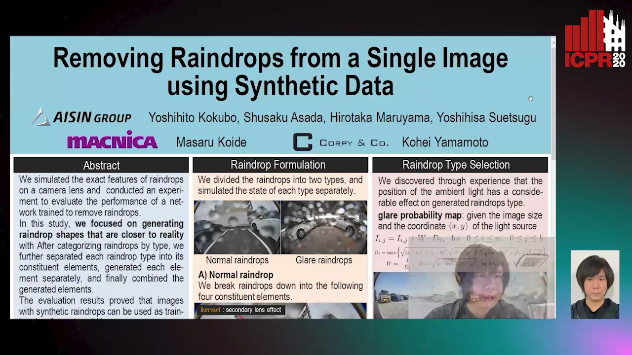
We simulated the exact features of raindrops on a camera lens and conducted an experiment to evaluate the performance of a network trained to remove raindrops using synthetic raindrop data. Although research has been conducted to precisely evaluate methods to remove raindrops, with some evaluation networks trained on images with real raindrops and others trained on images with synthetic raindrops, there have not been any studies that have directly compared the performance of two networks trained on each respective kind of image. In a previous study wherein images with synthetic raindrops were used for training, the network did not work effectively on images with real raindrops because the shapes of the raindrops were simulated using simple arithmetic expressions. In this study, we focused on generating raindrop shapes that are closer to reality with the aim of using these synthetic raindrops in images to develop a technique for removing real-world raindrops. After categorizing raindrops by type, we further separated each raindrop type into its constituent elements, generated each element separately, and finally combined the generated elements. The proposed technique was used to add images with synthetic raindrops to the training data, and when we evaluated the model, we confirmed that the technique's precision exceeded that of when only images with actual raindrops were used for training. The evaluation results proved that images with synthetic raindrops can be used as training data for real-world images.

Holistic Grid Fusion Based Stop Line Estimation

Runsheng Xu, Faezeh Tafazzoli, Li Zhang, Timo Rehfeld, Gunther Krehl, Arunava Seal

Responsive image

Auto-TLDR; Fused Multi-Sensory Data for Stop Lines Detection in Intersection Scenarios

Slides Similar

Intersection scenarios provide the most complex traffic situations in Autonomous Driving and Driving Assistance Systems. Knowing where to stop in advance in an intersection is an essential parameter in controlling the longitudinal velocity of the vehicle. Most of the existing methods in literature solely use cameras to detect stop lines, which is typically not sufficient in terms of detection range. To address this issue, we propose a method that takes advantage of fused multi-sensory data including stereo camera and lidar as input and utilizes a carefully designed convolutional neural network architecture to detect stop lines. Our experiments show that the proposed approach can improve detection range compared to camera data alone, works under heavy occlusion without observing the ground markings explicitly, is able to predict stop lines for all lanes and allows detection at a distance up to 50 meters.

Camera Calibration Using Parallel Line Segments

Gaku Nakano

Responsive image

Auto-TLDR; Closed-Form Calibration of Surveillance Cameras using Parallel 3D Line Segment Projections

Slides Poster Similar

This paper proposes a camera calibration method suitable for surveillance cameras using the image projection of parallel 3D line segments of the same length. We assume that vertical line segments are perpendicular to the ground plane and their bottom end-points are on the ground plane. Under this assumption, the camera parameters can be directly solved by at least two line segments without estimating vanishing points. Extending the minimal solution, we derive a closed-form solution to the least squares case with more than two line segments. Lens distortion is jointly optimized in bundle adjustment. Synthetic data evaluation shows that the best depression angle of a camera is around 50 degrees. In real data evaluation, we use body joints of pedestrians as vertical line segments. The experimental results on publicly available datasets show that the proposed method with a human pose detector can correctly calibrate wide-angle cameras including radial distortion.

User-Independent Gaze Estimation by Extracting Pupil Parameter and Its Mapping to the Gaze Angle

Sang Yoon Han, Nam Ik Cho

Responsive image

Auto-TLDR; Gaze Point Estimation using Pupil Shape for Generalization

Slides Poster Similar

Since gaze estimation plays a crucial role in recognizing human intentions, it has been researched for a long time, and its accuracy is ever increasing. However, due to the wide variation in eye shapes and focusing abilities between the individuals, accuracies of most algorithms vary depending on each person in the test group, especially when the initial calibration is not well performed. To alleviate the user-dependency, we attempt to derive features that are general for most people and use them as the input to a deep network instead of using the images as the input. Specifically, we use the pupil shape as the core feature because it is directly related to the 3D eyeball rotation, and thus the gaze direction. While existing deep learning methods learn the gaze point by extracting various features from the image, we focus on the mapping function from the eyeball rotation to the gaze point by using the pupil shape as the input. It is shown that the accuracy of gaze point estimation also becomes robust for the uncalibrated points by following the characteristics of the mapping function. Also, our gaze network learns the gaze difference to facilitate the re-calibration process to fix the calibration-drift problem that typically occurs with glass-type or head-mount devices.

Polarimetric Image Augmentation

Marc Blanchon, Fabrice Meriaudeau, Olivier Morel, Ralph Seulin, Desire Sidibe
Responsive image

Auto-TLDR; Polarimetric Augmentation for Deep Learning in Robotics Applications

Poster Similar

This paper deals with new augmentation methods for an unconventional imaging modality sensitive to the physics of the observed scene called polarimetry. In nature, polarized light is obtained by reflection or scattering. Robotics applications in urban environments are subject to many obstacles that can be specular and therefore provide polarized light. These areas are prone to segmentation errors using standard modalities but could be solved using information carried by the polarized light. Deep Convolutional Neural Networks (DCNNs) have shown excellent segmentation results, but require a significant amount of data to achieve best performances. The lack of data is usually overcomed by using augmentation methods. However, unlike RGB images, polarization images are not only scalar (intensity) images and standard augmentation techniques cannot be applied straightforwardly. We propose enhancing deep learning models through a regularized augmentation procedure applied to polarimetric data in order to characterize scenes more effectively under challenging conditions. We subsequently observe an average of 18.1% improvement in IoU between not augmented and regularized training procedures on real world data.

CARRADA Dataset: Camera and Automotive Radar with Range-Angle-Doppler Annotations

Arthur Ouaknine, Alasdair Newson, Julien Rebut, Florence Tupin, Patrick Pérez

Responsive image

Auto-TLDR; CARRADA: A dataset of synchronized camera and radar recordings with range-angle-Doppler annotations for autonomous driving

Slides Poster Similar

High quality perception is essential for autonomous driving (AD) systems. To reach the accuracy and robustness that are required by such systems, several types of sensors must be combined. Currently, mostly cameras and laser scanners (lidar) are deployed to build a representation of the world around the vehicle. While radar sensors have been used for a long time in the automotive industry, they are still under-used for AD despite their appealing characteristics (notably, their ability to measure the relative speed of obstacles and to operate even in adverse weather conditions). To a large extent, this situation is due to the relative lack of automotive datasets with real radar signals that are both raw and annotated. In this work, we introduce CARRADA, a dataset of synchronized camera and radar recordings with range-angle-Doppler annotations. We also present a semi-automatic annotation approach, which was used to annotate the dataset, and a radar semantic segmentation baseline, which we evaluate on several metrics. Both our code and dataset will be released.

Sensor-Independent Pedestrian Detection for Personal Mobility Vehicles in Walking Space Using Dataset Generated by Simulation

Takahiro Shimizu, Kenji Koide, Shuji Oishi, Masashi Yokozuka, Atsuhiko Banno, Motoki Shino
Responsive image

Auto-TLDR; CosPointPillars: A 3D Object Detection Method for Pedestrian Detection in Walking Spaces

Slides Poster Similar

Autonomous driving of a personal mobility vehicle such as a wheelchair in a walking space is necessary in the future as a means of transportation for the elderly and the physically handicapped. To realize this, accurate pedestrian detection is indispensable. As existing 3D object detection methods are trained with a roadway dataset, they are widely used for object detection in roadways. These methods have two major issues in the detection of objects in walking spaces. The first issue is that they are largely affected by the difference of the LIDAR models. To eliminate this issue, we propose a 3D object detection method, CosPointPillars. CosPointPillars does not take the reflection intensities of LIDAR point cloud, which cause a sensor model dependency, as input. Furthermore, CosPointPillars utilizes a cosine estimation network (CEN) to retain the detection accuracy. The second issue is that networks trained with a roadway dataset cannot sufficiently detect pedestrians (who are major traffic participants in walking spaces) located within a short distance; this is because the roadway dataset hardly includes nearby pedestrians. To solve this issue, we generated a new walking space dataset called SimDataset, which includes nearby pedestrians as a training dataset in the simulations. An experiment on the KITTI showed that the CEN helps in pedestrian detection in sparse point clouds. Furthermore, an experiment on a real walking space showed that SimDataset is suitable for pedestrian detection in such cases.

NetCalib: A Novel Approach for LiDAR-Camera Auto-Calibration Based on Deep Learning

Shan Wu, Amnir Hadachi, Damien Vivet, Yadu Prabhakar
Responsive image

Auto-TLDR; Automatic Calibration of LiDAR and Cameras using Deep Neural Network

Slides Poster Similar

A fusion of LiDAR and cameras have been widely used in many robotics applications such as classification, segmentation, object detection, and autonomous driving. It is essential that the LiDAR sensor can measure distances accurately, which is a good complement to the cameras. Hence, calibrating sensors before deployment is a mandatory step. The conventional methods include checkerboards, specific patterns, or human labeling, which is trivial and human-labor extensive if we do the same calibration process every time. The main propose of this research work is to build a deep neural network that is capable of automatically finding the geometric transformation between LiDAR and cameras. The results show that our model manages to find the transformations from randomly sampled artificial errors. Besides, our work is open-sourced for the community to fully utilize the advances of the methodology for developing more the approach, initiating collaboration, and innovation in the topic.

AerialMPTNet: Multi-Pedestrian Tracking in Aerial Imagery Using Temporal and Graphical Features

Maximilian Kraus, Seyed Majid Azimi, Emec Ercelik, Reza Bahmanyar, Peter Reinartz, Alois Knoll
Responsive image

Auto-TLDR; AerialMPTNet: A novel approach for multi-pedestrian tracking in geo-referenced aerial imagery by fusing appearance features

Slides Poster Similar

Multi-pedestrian tracking in aerial imagery has several applications such as large-scale event monitoring, disaster management, search-and-rescue missions, and as input into predictive crowd dynamic models. Due to the challenges such as the large number and the tiny size of the pedestrians (e.g., 4 x 4 pixels) with their similar appearances as well as different scales and atmospheric conditions of the images with their extremely low frame rates (e.g., 2 fps), current state-of-the-art algorithms including the deep learning-based ones are unable to perform well. In this paper, we propose AerialMPTNet, a novel approach for multi-pedestrian tracking in geo-referenced aerial imagery by fusing appearance features from a Siamese Neural Network, movement predictions from a Long Short-Term Memory, and pedestrian interconnections from a GraphCNN. In addition, to address the lack of diverse aerial multi-pedestrian tracking datasets, we introduce the Aerial Multi-Pedestrian Tracking (AerialMPT) dataset consisting of 307 frames and 44,740 pedestrians annotated. To the best of our knowledge, AerialMPT is the largest and most diverse dataset to this date and will be released publicly. We evaluate AerialMPTNet on AerialMPT and KIT AIS, and benchmark with several state-of-the-art tracking methods. Results indicate that AerialMPTNet significantly outperforms other methods on accuracy and time-efficiency.

Generic Document Image Dewarping by Probabilistic Discretization of Vanishing Points

Gilles Simon, Salvatore Tabbone
Responsive image

Auto-TLDR; Robust Document Dewarping using vanishing points

Slides Poster Similar

Document images dewarping is still a challenge especially when documents are captured with one camera in an uncontrolled environment. In this paper we propose a generic approach based on vanishing points (VP) to reconstruct the 3D shape of document pages. Unlike previous methods we do not need to segment the text included in the documents. Therefore, our approach is less sensitive to pre-processing and segmentation errors. The computation of the VPs is robust and relies on the a-contrario framework, which has only one parameter whose setting is based on probabilistic reasoning instead of experimental tuning. Thus, our method can be applied to any kind of document including text and non-text blocks and extended to other kind of images. Experimental results show that the proposed method is robust to a variety of distortions.

IPT: A Dataset for Identity Preserved Tracking in Closed Domains

Thomas Heitzinger, Martin Kampel

Responsive image

Auto-TLDR; Identity Preserved Tracking Using Depth Data for Privacy and Privacy

Slides Poster Similar

We present a public dataset for Identity Preserved Tracking (IPT) consisting of sequences of depth data recorded using an Orbbec Astra depth sensor. The dataset features sequences in ten different locations with a high amount of background variation and is designed to be applicable to a wide range of tasks. Its labeling is versatile, allowing for tracking in either 3d space or image coordinates. Next to frame-by-frame 3d and inferred bounding box labeling we provide supplementary annotation of camera poses and room layouts, split in multiple semantically distinct categories. Intended use-cases are applications where both a high level understanding of scene understanding and privacy are central points of consideration, such as active and assisted living (AAL), security and industrial safety. Compared to similar public datasets IPT distinguishes itself with its sequential data format, 3d instance labeling and room layout annotation. We present baseline object detection results in image coordinates using a YOLOv3 network architecture and implement a background model suitable for online tracking applications to increase detection accuracy. Additionally we propose a novel volumetric non-maximum suppression (V-NMS) approach, taking advantage of known room geometry. Last we provide baseline person tracking results utilizing Multiple Object Tracking Challenge (MOTChallenge) evaluation metrics of the CVPR19 benchmark.

RISEdb: A Novel Indoor Localization Dataset

Carlos Sanchez Belenguer, Erik Wolfart, Álvaro Casado Coscollá, Vitor Sequeira

Responsive image

Auto-TLDR; Indoor Localization Using LiDAR SLAM and Smartphones: A Benchmarking Dataset

Slides Poster Similar

In this paper we introduce a novel public dataset for developing and benchmarking indoor localization systems. We have selected and 3D mapped a set of representative indoor environments including a large office building, a conference room, a workshop, an exhibition area and a restaurant. Our acquisition pipeline is based on a portable LiDAR SLAM backpack to map the buildings and to accurately track the pose of the user as it moves freely inside them. We introduce the calibration procedures that enable us to acquire and geo-reference live data coming from different independent sensors rigidly attached to the backpack. This has allowed us to collect long sequences of spherical and stereo images, together with all the sensor readings coming from a consumer smartphone and locate them inside the map with centimetre accuracy. The dataset addresses many of the limitations of existing indoor localization datasets regarding the scale and diversity of the mapped buildings; the number of acquired sequences under varying conditions; the accuracy of the ground-truth trajectory; the availability of a detailed 3D model and the availability of different sensor types. It enables the benchmarking of existing and the development of new indoor localization approaches, in particular for deep learning based systems that require large amounts of labeled training data.

S-VoteNet: Deep Hough Voting with Spherical Proposal for 3D Object Detection

Yanxian Chen, Huimin Ma, Xi Li, Xiong Luo

Responsive image

Auto-TLDR; S-VoteNet: 3D Object Detection with Spherical Bounded Box Prediction

Slides Poster Similar

Current 3D object detection methods adopt an analogous box prediction structure with the 2D methods, which predict center and size of the object simultaneously in a box regression procedure, leading to the poor performance of 3D detector to a great extent. In this work, we propose S-VoteNet, which converts the prediction of 3D bounding box into two parts: center prediction and size prediction. By introducing a novel spherical proposal, S-VoteNet uses vote groups to predict the center and radius of object rather than all parameters of 3D bounding box. The prediction of radius is used to constrain the object size, and the radius-based spherical center loss is applied to measure the geometric distance between the proposal and ground-truth. To make better use of the geometric information provided by point cloud, S-VoteNet gathers seed points whose corresponding votes are within the vote groups for seed group generation. Seed groups are then consumed for box size regression and orientation estimation. By decoupling the localization and size estimation, our method effectively reduces the regression pressure of the 3D detector. Experimental results on SUN RGB-D 3D detection benchmark demonstrate that our S-VoteNet achieves state-of-the-art performance by using only point cloud as input.

SIMCO: SIMilarity-Based Object COunting

Marco Godi, Christian Joppi, Andrea Giachetti, Marco Cristani

Responsive image

Auto-TLDR; SIMCO: An Unsupervised Multi-class Object Counting Approach on InShape

Slides Poster Similar

We present SIMCO, a completely agnostic multi-class object counting approach. SIMCO starts by detecting foreground objects through a novel Mask RCNN-based architecture trained beforehand (just once) on a brand-new synthetic 2D shape dataset, InShape; the idea is to highlight every object resembling a primitive 2D shape (circle, square, rectangle, etc.). Each object detected is described by a low-dimensional embedding, obtained from a novel similarity-based head branch; this latter implements a triplet loss, encouraging similar objects (same 2D shape + color and scale) to map close. Subsequently, SIMCO uses this embedding for clustering, so that different 'classes' of similar objects can emerge and be counted, making SIMCO the very first multi-class unsupervised counter. The only required assumption is that repeated objects are present in the image. Experiments show that SIMCO provides state-of-the-art scores on counting benchmarks and that it can also help in many challenging image understanding tasks.

Position-Aware and Symmetry Enhanced GAN for Radial Distortion Correction

Yongjie Shi, Xin Tong, Jingsi Wen, He Zhao, Xianghua Ying, Jinshi Hongbin Zha

Responsive image

Auto-TLDR; Generative Adversarial Network for Radial Distorted Image Correction

Slides Poster Similar

This paper presents a novel method based on the generative adversarial network for radial distortion correction. Instead of generating a corrected image, our generator predicts a pixel flow map to measure the pixel offset between the distorted and corrected image. The quality of the generated pixel flow map and the warped image are judged by the discriminator. As texture far away from the image center has strong distortion, we develop an Adaptive Inverted Foveal layer which can transform the deformation to the intensity of the image to exploit this property. Rotation symmetry enhanced convolution kernels are applied to extract geometric features of different orientations explicitly. These learned features are recalibrated using the Squeeze-and-Excitation block to assign different weights for different directions. Moreover, we construct a first real-world radial distorted image dataset RD600 annotated with ground truth to evaluate our proposed method. We conduct extensive experiments to validate the effectiveness of each part of our framework. The further experiment shows our approach outperforms previous methods in both synthetic and real-world datasets quantitatively and qualitatively.

A Hierarchical Framework for Leaf Instance Segmentation: Application to Plant Phenotyping

Swati Bhugra, Kanish Garg, Santanu Chaudhury, Brejesh Lall

Responsive image

Auto-TLDR; Under-segmentation of plant image using a graph based formulation to extract leaf shape knowledge for the task of leaf instance segmentation

Slides Poster Similar

Image based analysis of plants is a high-throughput and non-invasive approach to study plant traits. Based on plant image data, the quantitative estimation of many plant traits (leaf area index, biomass etc.) is associated with accurate segmentation of individual leaves. However, this task is challenging due to the presence of overlapped leaves and lack of discernible boundaries between them. In addition, variability in leaf shapes and arrangement among different plant species limits the broad utilisation of current leaf instance segmentation algorithms. In this paper, we propose a novel framework that relies on under-segmentation of plant image using a graph based formulation to extract leaf shape knowledge for the task of leaf instance segmentation. These shape priors are generated based on leaf shape characteristics independent of plant species. We demonstrate the performance of the proposed framework across multiple plant dataset i.e. Arabidopsis, Komatsuna and Salad. Experimental results indicate its broad utility.

Tiny Object Detection in Aerial Images

Jinwang Wang, Wen Yang, Haowen Guo, Ruixiang Zhang, Gui-Song Xia
Responsive image

Auto-TLDR; Tiny Object Detection in Aerial Images Using Multiple Center Points Based Learning Network

Slides Similar

Object detection in Earth Vision has achieved great progress in recent years. However, tiny object detection in aerial images remains a very challenging problem since the tiny objects contain a small number of pixels and are easily confused with the background. To advance tiny object detection research in aerial images, we present a new dataset for Tiny Object Detection in Aerial Images (AI-TOD). Specifically, AI-TOD comes with 700,621 object instances for eight categories across 28,036 aerial images. Compared to existing object detection datasets in aerial images, the mean size of objects in AI-TOD is about 12.8 pixels, which is much smaller than others. To build a benchmark for tiny object detection in aerial images, we evaluate the state-of-the-art object detectors on our AI-TOD dataset. Experimental results show that direct application of these approaches on AI-TOD produces suboptimal object detection results, thus new specialized detectors for tiny object detection need to be designed. Therefore, we propose a multiple center points based learning network (M-CenterNet) to improve the localization performance of tiny object detection, and experimental results show the significant performance gain over the competitors.

Learning to Rank for Active Learning: A Listwise Approach

Minghan Li, Xialei Liu, Joost Van De Weijer, Bogdan Raducanu

Responsive image

Auto-TLDR; Learning Loss for Active Learning

Slides Similar

Active learning emerged as an alternative to alleviate the effort to label huge amount of data for data-hungry applications (such as image/video indexing and retrieval, autonomous driving, etc.). The goal of active learning is to automatically select a number of unlabeled samples for annotation (according to a budget), based on an acquisition function, which indicates how valuable a sample is for training the model. The learning loss method is a task-agnostic approach which attaches a module to learn to predict the target loss of unlabeled data, and select data with the highest loss for labeling. In this work, we follow this strategy but we define the acquisition function as a learning to rank problem and rethink the structure of the loss prediction module, using a simple but effective listwise approach. Experimental results on four datasets demonstrate that our method outperforms recent state-of-the-art active learning approaches for both image classification and regression tasks.

Inner Eye Canthus Localization for Human Body Temperature Screening

Claudio Ferrari, Lorenzo Berlincioni, Marco Bertini, Alberto Del Bimbo

Responsive image

Auto-TLDR; Automatic Localization of the Inner Eye Canthus in Thermal Face Images using 3D Morphable Face Model

Slides Poster Similar

In this paper, we propose an automatic approach for localizing the inner eye canthus in thermal face images. We first coarsely detect 5 facial keypoints corresponding to the center of the eyes, the nosetip and the ears. Then we compute a sparse 2D-3D points correspondence using a 3D Morphable Face Model (3DMM). This correspondence is used to project the entire 3D face onto the image, and subsequently locate the inner eye canthus. Detecting this location allows to obtain the most precise body temperature measurement for a person using a thermal camera. We evaluated the approach on a thermal face dataset provided with manually annotated landmarks. However, such manual annotations are normally conceived to identify facial parts such as eyes, nose and mouth, and are not specifically tailored for localizing the eye canthus region. As additional contribution, we enrich the original dataset by using the annotated landmarks to deform and project the 3DMM onto the images. Then, by manually selecting a small region corresponding to the eye canthus, we enrich the dataset with additional annotations. By using the manual landmarks, we ensure the correctness of the 3DMM projection, which can be used as ground-truth for future evaluations. Moreover, we supply the dataset with the 3D head poses and per-point visibility masks for detecting self-occlusions. The data will be publicly released.

Uncertainty Guided Recognition of Tiny Craters on the Moon

Thorsten Wilhelm, Christian Wöhler
Responsive image

Auto-TLDR; Accurately Detecting Tiny Craters in Remote Sensed Images Using Deep Neural Networks

Slides Poster Similar

Accurately detecting craters in remotely sensed images is an important task when analysing the properties of planetary bodies. Commonly, only large craters in the range of several kilometres are detected. In this work we provide the first example of automatically detecting tiny craters in the range of several meters with the help of a deep neural network by using only a small set of annotated craters. Additionally, we propose a novel way to group overlapping detections and replace the commonly used non-maximum suppression with a probabilistic treatment. As a result, we receive valuable uncertainty estimates of the detections and the aggregated detections are shown to be vastly superior.

Vehicle Lane Merge Visual Benchmark

Kai Cordes, Hellward Broszio

Responsive image

Auto-TLDR; A Benchmark for Automated Cooperative Maneuvering Using Multi-view Video Streams and Ground Truth Vehicle Description

Slides Poster Similar

Automated driving is regarded as the most promising technology for improving road safety in the future. In this context, connected vehicles have an important role regarding their ability to perform cooperative maneuvers for challenging traffic situations. We propose a benchmark for automated cooperative maneuvers. The targeted cooperative maneuver is the vehicle lane merge where a vehicle on the acceleration lane merges into the traffic of a motorway. The benchmark enables the evaluation of vehicle localization approaches as well as the study of cooperative maneuvers. It consists of temporally synchronized multi-view video streams, highly accurate camera calibration, and ground truth vehicle descriptions, including position, heading, speed, and shape. For benchmark generation, the lane merge maneuver is performed by human drivers on a test track, resulting in 120 lane merge data sets with various traffic situations and video recording conditions.

Orthographic Projection Linear Regression for Single Image 3D Human Pose Estimation

Yahui Zhang, Shaodi You, Theo Gevers
Responsive image

Auto-TLDR; A Deep Neural Network for 3D Human Pose Estimation from a Single 2D Image in the Wild

Slides Poster Similar

3D human pose estimation from a single 2D image in the wild is an important computer vision task but yet extremely challenging. Unlike images taken from indoor and well constrained environments, 2D outdoor images in the wild are extremely complex because of varying imaging conditions. Furthermore, 2D images usually do not have corresponding 3D pose ground truth making a supervised approach ill constrained. Therefore, in this paper, we propose to associate the 3D human pose, the 2D human pose projection and the 2D image appearance through a new orthographic projection based linear regression module. Unlike existing reprojection based approaches, our orthographic projection and regression do not suffer from small angle problems, which usually lead to overfitting in the depth dimension. Hence, we propose a deep neural network which adopts the 2D pose, 3D pose regression and orthographic projection linear regression module. The proposed method shows state-of-the art performance on the Human3.6M dataset and generalizes well to in-the-wild images.

Single-Modal Incremental Terrain Clustering from Self-Supervised Audio-Visual Feature Learning

Reina Ishikawa, Ryo Hachiuma, Akiyoshi Kurobe, Hideo Saito
Responsive image

Auto-TLDR; Multi-modal Variational Autoencoder for Terrain Type Clustering

Slides Poster Similar

The key to an accurate understanding of terrain is to extract the informative features from the multi-modal data obtained from different devices. Sensors, such as RGB cameras, depth sensors, vibration sensors, and microphones, are used as the multi-modal data. Many studies have explored ways to use them, especially in the robotics field. Some papers have successfully introduced single-modal or multi-modal methods. However, in practice, robots can be faced with extreme conditions; microphones do not work well in the crowded scenes, and an RGB camera cannot capture terrains well in the dark. In this paper, we present a novel framework using the multi-modal variational autoencoder and the Gaussian mixture model clustering algorithm on image data and audio data for terrain type clustering. Our method enables the terrain type clustering even if one of the modalities (either image or audio) is missing at the test-time. We evaluated the clustering accuracy with a conventional multi-modal terrain type clustering method and we conducted ablation studies to show the effectiveness of our approach.

P2D: A Self-Supervised Method for Depth Estimation from Polarimetry

Marc Blanchon, Desire Sidibe, Olivier Morel, Ralph Seulin, Daniel Braun, Fabrice Meriaudeau
Responsive image

Auto-TLDR; Polarimetric Regularization for Monocular Depth Estimation

Slides Poster Similar

Monocular depth estimation is a recurring subject in the field of computer vision. Its ability to describe scenes via a depth map while reducing the constraints related to the formulation of perspective geometry tends to favor its use. However, despite the constant improvement of algorithms, most methods exploit only colorimetric information. Consequently, robustness to events to which the modality is not sensitive to, like specularity or transparency, is neglected. In response to this phenomenon, we propose using polarimetry as an input for a self-supervised monodepth network. Therefore, we propose exploiting polarization cues to encourage accurate reconstruction of scenes. Furthermore, we include a term of polarimetric regularization to state-of-the-art method to take specific advantage of the data. Our method is evaluated both qualitatively and quantitatively demonstrating that the contribution of this new information as well as an enhanced loss function improves depth estimation results, especially for specular areas.

Yolo+FPN: 2D and 3D Fused Object Detection with an RGB-D Camera

Ya Wang

Responsive image

Auto-TLDR; Yolo+FPN: Combining 2D and 3D Object Detection for Real-Time Object Detection

Slides Poster Similar

In this paper we propose a new deep neural network system, called Yolo+FPN, which fuses both 2D and 3D object detection algorithms to achieve better real-time object detection results and faster inference speed, to be used on real robots. Finding an optimized fusion strategy to efficiently combine 3D object detection with 2D detection information is useful and challenging for both indoor and outdoor robots. In order to satisfy real-time requirements, a trade-off between accuracy and efficiency is needed. We not only have improved training and test accuracies and lower mean losses on the KITTI object detection benchmark, but also achieve better average precision on 3D detection of all classes in three levels of difficulty. Also, we implemented Yolo+FPN system using an RGB-D camera, and compared the speed of 2D and 3D object detection using different GPUs. For the real implementation of both indoor and outdoor scenes, we focus on person detection, which is the most challenging and important among the three classes.

Ground-truthing Large Human Behavior Monitoring Datasets

Tehreem Qasim, Robert Fisher, Naeem Bhatti
Responsive image

Auto-TLDR; Semi-automated Groundtruthing for Large Video Datasets

Slides Poster Similar

We present a groundtruthing approach which is applicable to large video datasets collected for studying people’s behavior, and which are recorded at a low frame per second (fps) rate. Groundtruthing a large dataset manually is a time consuming task and is prone to errors. The proposed approach is semi-automated (using a combination of deepnet and traditional image analysis) to minimize human labeler’s interaction with the video frames. The framework employs mask-rcnn as a people counter followed by human assisted semi-automated tests to correct the wrong labels. Subsequently, a bounding box extraction algorithm is used which is fully automated for frames with a single person and semi-automated for frames with two or more people. We also propose a methodology for anomaly detection i.e., collapse on table or floor. Behavior recognition is performed by using a fine-tuned alexnet convolutional neural network. The people detection and behavior analysis components of the framework are primarily designed to help reduce human labor in ground-truthing so that minimal human involvement is required. They are not meant to be employed as fully automated state-of-the-art systems. The proposed approach is validated on a new dataset presented in this paper, containing human activity in an indoor office environment and recorded at 1 fps as well as an indoor video sequence recorded at 15 fps. Experimental results show a significant reduction in human labor involved in the process of ground-truthing i.e., the number of potential clicks for office dataset was reduced by 99.2% and for the additional test video by 99.7%.

RONELD: Robust Neural Network Output Enhancement for Active Lane Detection

Zhe Ming Chng, Joseph Mun Hung Lew, Jimmy Addison Lee

Responsive image

Auto-TLDR; Real-Time Robust Neural Network Output Enhancement for Active Lane Detection

Slides Poster Similar

Accurate lane detection is critical for navigation in autonomous vehicles, particularly the active lane which demarcates the single road space that the vehicle is currently traveling on. Recent state-of-the-art lane detection algorithms utilize convolutional neural networks (CNNs) to train deep learning models on popular benchmarks such as TuSimple and CULane. While each of these models works particularly well on train and test inputs obtained from the same dataset, the performance drops significantly on unseen datasets of different environments. In this paper, we present a real-time robust neural network output enhancement for active lane detection (RONELD) method to identify, track, and optimize active lanes from deep learning probability map outputs. We first adaptively extract lane points from the probability map outputs, followed by detecting curved and straight lanes before using weighted least squares linear regression on straight lanes to fix broken lane edges resulting from fragmentation of edge maps in real images. Lastly, we hypothesize true active lanes through tracking preceding frames. Experimental results demonstrate an up to two-fold increase in accuracy using RONELD on cross-dataset validation tests.

Human Embryo Cell Centroid Localization and Counting in Time-Lapse Sequences

Lisette Lockhart, Parvaneh Saeedi, Jason Au, Jon Havelock

Responsive image

Auto-TLDR; Automated Time-Lapse Estimation of Embryo Cell Stage in Time-lapse Sequences

Slides Poster Similar

Couples suffering from infertility issues often use In Vitro Fertilization (IVF) treatment to give birth. Continuous embryo monitoring with time-lapse imaging enables time-based development metrics alongside visual features to assess an embryo’s quality before transfer. Tracking embryonic cell development provides valuable information about its likelihood of leading to a positive pregnancy. Automating this task is challenging due to cell overlap, occlusion, and variation. In this paper, cell stage is identified by counting detected cell centroids in early embryo time-lapse sequences. A convolutional regression network is trained on Gaussian-annotated centroid maps to localize cell centroids. Added network attention blocks encode spatio-temporal relationship in time-lapse sequences to emphasize relevant features in the current frame based on previous frame and cell (i.e. blastomere) movement. The proposed approach was applied to 108 embryo sequences including 1- to 4-cell stage, achieving cell centroid localization distance error of 3.98 pixels, cell detection rate 80.9%, and cell counting accuracy of 80.2%.

BAT Optimized CNN Model Identifies Water Stress in Chickpea Plant Shoot Images

Shiva Azimi, Taranjit Kaur, Tapan Gandhi

Responsive image

Auto-TLDR; BAT Optimized ResNet-18 for Stress Classification of chickpea shoot images under water deficiency

Slides Poster Similar

Stress due to water deficiency in plants can significantly lower the agricultural yield. It can affect many visible plant traits such as size and surface area, the number of leaves and their color, etc. In recent years, computer vision-based plant phenomics has emerged as a promising tool for plant research and management. Such techniques have the advantage of being non-destructive, non-evasive, fast, and offer high levels of automation. Pulses like chickpeas play an important role in ensuring food security in poor countries owing to their high protein and nutrition content. In the present work, we have built a dataset comprising of two varieties of chickpea plant shoot images under different moisture stress conditions. Specifically, we propose a BAT optimized ResNet-18 model for classifying stress induced by water deficiency using chickpea shoot images. BAT algorithm identifies the optimal value of the mini-batch size to be used for training rather than employing the traditional manual approach of trial and error. Experimentation on two crop varieties (JG and Pusa) reveals that BAT optimized approach achieves an accuracy of 96% and 91% for JG and Pusa varieties that is better than the traditional method by 4%. The experimental results are also compared with state of the art CNN models like Alexnet, GoogleNet, and ResNet-50. The comparison results demonstrate that the proposed BAT optimized ResNet-18 model achieves higher performance than the comparison counterparts.

Extending Single Beam Lidar to Full Resolution by Fusing with Single Image Depth Estimation

Yawen Lu, Yuxing Wang, Devarth Parikh, Guoyu Lu

Responsive image

Auto-TLDR; Self-supervised LIDAR for Low-Cost Depth Estimation

Slides Similar

Depth estimation is playing an important role in indoor and outdoor scene understanding, autonomous driving, augmented reality and many other tasks. Vehicles and robotics are able to use active illumination sensors such as LIDAR to receive high precision depth estimation. However, high-resolution Lidars are usually too expensive, which limits its massive production on various applications. Though single beam LIDAR enjoys the benefits of low cost, one beam depth sensing is not usually sufficient to perceive the surrounding environment in many scenarios. In this paper, we propose a learning-based framework to explore to replicate similar or even higher performance as costly LIDARs with our designed self-supervised network and a low-cost single-beam LIDAR. After the accurate calibration with a visible camera, the single beam LIDAR can adjust the scale uncertainty of the depth map estimated by the visible camera. The adjusted depth map enjoys the benefits of high resolution and sensing accuracy as high beam LIDAR and maintains low-cost as single beam LIDAR. Thus we can achieve similar sensing effect of high beam LIDAR with more than a 50-100 times cheaper price (e.g., \$80000 Velodyne HDL-64E LIDAR v.s. \$1000 SICK TIM-781 2D LIDAR and normal camera). The proposed approach is verified on our collected dataset and public dataset with superior depth-sensing performance.

Multi-Camera Sports Players 3D Localization with Identification Reasoning

Yukun Yang, Ruiheng Zhang, Wanneng Wu, Yu Peng, Xu Min

Responsive image

Auto-TLDR; Probabilistic and Identified Occupancy Map for Sports Players 3D Localization

Slides Poster Similar

Multi-camera sports players 3D localization is always a challenging task due to heavy occlusions in crowded sports scene. Traditional methods can only provide players locations without identification information. Existing methods of localization may cause ambiguous detection and unsatisfactory precision and recall, especially when heavy occlusions occur. To solve this problem, we propose a generic localization method by providing distinguishable results that have the probabilities of locations being occupied by players with unique ID labels. We design the algorithms with a multi-dimensional Bayesian model to create a Probabilistic and Identified Occupancy Map (PIOM). By using this model, we jointly apply deep learning-based object segmentation and identification to obtain sports players probable positions and their likely identification labels. This approach not only provides players 3D locations but also gives their ID information that are distinguishable from others. Experimental results demonstrate that our method outperforms the previous localization approaches with reliable and distinguishable outcomes.