Vehicle Lane Merge Visual Benchmark

Kai Cordes, Hellward Broszio

Responsive image

Auto-TLDR; A Benchmark for Automated Cooperative Maneuvering Using Multi-view Video Streams and Ground Truth Vehicle Description

Slides Poster

Automated driving is regarded as the most promising technology for improving road safety in the future. In this context, connected vehicles have an important role regarding their ability to perform cooperative maneuvers for challenging traffic situations. We propose a benchmark for automated cooperative maneuvers. The targeted cooperative maneuver is the vehicle lane merge where a vehicle on the acceleration lane merges into the traffic of a motorway. The benchmark enables the evaluation of vehicle localization approaches as well as the study of cooperative maneuvers. It consists of temporally synchronized multi-view video streams, highly accurate camera calibration, and ground truth vehicle descriptions, including position, heading, speed, and shape. For benchmark generation, the lane merge maneuver is performed by human drivers on a test track, resulting in 120 lane merge data sets with various traffic situations and video recording conditions.

Similar papers

Visual Prediction of Driver Behavior in Shared Road Areas

Peter Gawronski, Darius Burschka

Responsive image

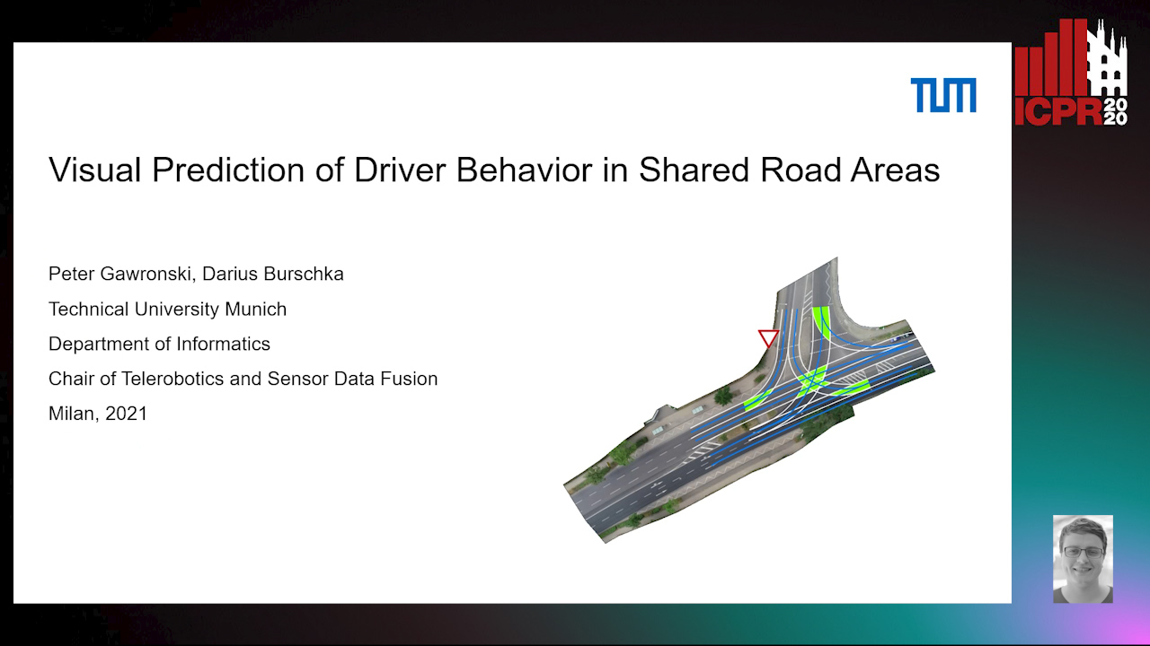
Auto-TLDR; Predicting Vehicle Behavior in Shared Road Segment Intersections Using Topological Knowledge

Slides Poster Similar

We propose a framework to analyze and predict vehicles behavior within shared road segments like intersections or at narrow passages. The system first identifies critical interaction regions based on topological knowledge. It then checks possible colliding trajectories from the current state of vehicles in the scene, defined by overlapping occupation times in road segments. For each possible interaction area, it analyzes the behavioral profile of both vehicles. Depending on right of way and (unpredictable) behavior parameters, different outcomes are expected and will be tested against input. The interaction between vehicles is analyzed over a short time horizon based on an initial action from one vehicle and the reaction by the other. The vehicle to yield most often performs the first action and the response of the opponent vehicle is measured after a reaction time. The observed reaction is classified by attention, if there was a reaction at all, and the collaboration of the opponent vehicle, whether it helps to resolve the situation or hinders it. The output is a classification of behavior of involved vehicles in terms of active participation in the interaction and assertiveness of driving style in terms of collaborative or disruptive behavior. The additional knowledge is used to refine the prediction of intention and outcome of a scene, which is then compared to the current status to catch unexpected behavior. The applicability of the concept and ideas of the approach is validated on scenarios from the recent Intersection Drone (inD) data set.

Holistic Grid Fusion Based Stop Line Estimation

Runsheng Xu, Faezeh Tafazzoli, Li Zhang, Timo Rehfeld, Gunther Krehl, Arunava Seal

Responsive image

Auto-TLDR; Fused Multi-Sensory Data for Stop Lines Detection in Intersection Scenarios

Slides Similar

Intersection scenarios provide the most complex traffic situations in Autonomous Driving and Driving Assistance Systems. Knowing where to stop in advance in an intersection is an essential parameter in controlling the longitudinal velocity of the vehicle. Most of the existing methods in literature solely use cameras to detect stop lines, which is typically not sufficient in terms of detection range. To address this issue, we propose a method that takes advantage of fused multi-sensory data including stereo camera and lidar as input and utilizes a carefully designed convolutional neural network architecture to detect stop lines. Our experiments show that the proposed approach can improve detection range compared to camera data alone, works under heavy occlusion without observing the ground markings explicitly, is able to predict stop lines for all lanes and allows detection at a distance up to 50 meters.

Yolo+FPN: 2D and 3D Fused Object Detection with an RGB-D Camera

Ya Wang

Responsive image

Auto-TLDR; Yolo+FPN: Combining 2D and 3D Object Detection for Real-Time Object Detection

Slides Poster Similar

In this paper we propose a new deep neural network system, called Yolo+FPN, which fuses both 2D and 3D object detection algorithms to achieve better real-time object detection results and faster inference speed, to be used on real robots. Finding an optimized fusion strategy to efficiently combine 3D object detection with 2D detection information is useful and challenging for both indoor and outdoor robots. In order to satisfy real-time requirements, a trade-off between accuracy and efficiency is needed. We not only have improved training and test accuracies and lower mean losses on the KITTI object detection benchmark, but also achieve better average precision on 3D detection of all classes in three levels of difficulty. Also, we implemented Yolo+FPN system using an RGB-D camera, and compared the speed of 2D and 3D object detection using different GPUs. For the real implementation of both indoor and outdoor scenes, we focus on person detection, which is the most challenging and important among the three classes.

HPERL: 3D Human Pose Estimastion from RGB and LiDAR

Michael Fürst, Shriya T.P. Gupta, René Schuster, Oliver Wasenmüler, Didier Stricker

Responsive image

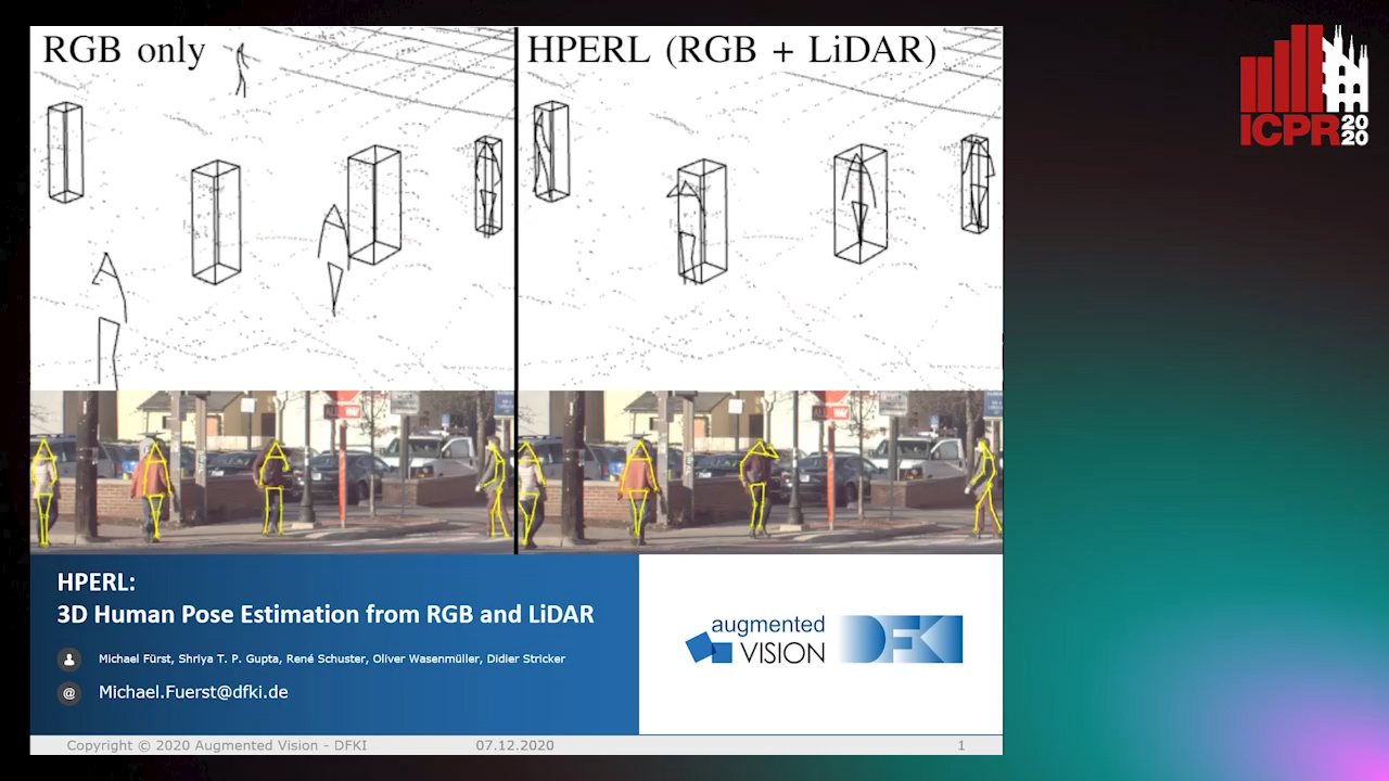
Auto-TLDR; 3D Human Pose Estimation Using RGB and LiDAR Using Weakly-Supervised Approach

Slides Poster Similar

In-the-wild human pose estimation has a huge potential for various fields, ranging from animation and action recognition to intention recognition and prediction for autonomous driving. The current state-of-the-art is focused only on RGB and RGB-D approaches for predicting the 3D human pose. However, not using precise LiDAR depth information limits the performance and leads to very inaccurate absolute pose estimation. With LiDAR sensors becoming more affordable and common on robots and autonomous vehicle setups, we propose an end-to-end architecture using RGB and LiDAR to predict the absolute 3D human pose with unprecedented precision. Additionally, we introduce a weakly-supervised approach to generate 3D predictions using 2D pose annotations from PedX. This allows for many new opportunities in the field of 3D human pose estimation.

NetCalib: A Novel Approach for LiDAR-Camera Auto-Calibration Based on Deep Learning

Shan Wu, Amnir Hadachi, Damien Vivet, Yadu Prabhakar

Responsive image

Auto-TLDR; Automatic Calibration of LiDAR and Cameras using Deep Neural Network

Slides Poster Similar

A fusion of LiDAR and cameras have been widely used in many robotics applications such as classification, segmentation, object detection, and autonomous driving. It is essential that the LiDAR sensor can measure distances accurately, which is a good complement to the cameras. Hence, calibrating sensors before deployment is a mandatory step. The conventional methods include checkerboards, specific patterns, or human labeling, which is trivial and human-labor extensive if we do the same calibration process every time. The main propose of this research work is to build a deep neural network that is capable of automatically finding the geometric transformation between LiDAR and cameras. The results show that our model manages to find the transformations from randomly sampled artificial errors. Besides, our work is open-sourced for the community to fully utilize the advances of the methodology for developing more the approach, initiating collaboration, and innovation in the topic.

RISEdb: A Novel Indoor Localization Dataset

Carlos Sanchez Belenguer, Erik Wolfart, Álvaro Casado Coscollá, Vitor Sequeira

Responsive image

Auto-TLDR; Indoor Localization Using LiDAR SLAM and Smartphones: A Benchmarking Dataset

Slides Poster Similar

In this paper we introduce a novel public dataset for developing and benchmarking indoor localization systems. We have selected and 3D mapped a set of representative indoor environments including a large office building, a conference room, a workshop, an exhibition area and a restaurant. Our acquisition pipeline is based on a portable LiDAR SLAM backpack to map the buildings and to accurately track the pose of the user as it moves freely inside them. We introduce the calibration procedures that enable us to acquire and geo-reference live data coming from different independent sensors rigidly attached to the backpack. This has allowed us to collect long sequences of spherical and stereo images, together with all the sensor readings coming from a consumer smartphone and locate them inside the map with centimetre accuracy. The dataset addresses many of the limitations of existing indoor localization datasets regarding the scale and diversity of the mapped buildings; the number of acquired sequences under varying conditions; the accuracy of the ground-truth trajectory; the availability of a detailed 3D model and the availability of different sensor types. It enables the benchmarking of existing and the development of new indoor localization approaches, in particular for deep learning based systems that require large amounts of labeled training data.

Street-Map Based Validation of Semantic Segmentation in Autonomous Driving

Laura Von Rueden, Tim Wirtz, Fabian Hueger, Jan David Schneider, Nico Piatkowski, Christian Bauckhage

Responsive image

Auto-TLDR; Semantic Segmentation Mask Validation Using A-priori Knowledge from Street Maps

Slides Poster Similar

Artificial intelligence for autonomous driving must meet strict requirements on safety and robustness, which motivates the thorough validation of learned models. However, current validation approaches mostly require ground truth data and are thus both cost-intensive and limited in their applicability. We propose to overcome these limitations by a model agnostic validation using a-priori knowledge from street maps. In particular, we show how to validate semantic segmentation masks and demonstrate the potential of our approach using OpenStreetMap. We introduce validation metrics that indicate false positive or negative road segments. Besides the validation approach, we present a method to correct the vehicle's GPS position so that a more accurate localization can be used for the street map based validation. Lastly, we present quantitative results on the Cityscapes dataset indicating that our validation approach can indeed uncover errors in semantic segmentation masks.

Lane Detection Based on Object Detection and Image-To-Image Translation

Hiroyuki Komori, Kazunori Onoguchi

Responsive image

Auto-TLDR; Lane Marking and Road Boundary Detection from Monocular Camera Images using Inverse Perspective Mapping

Slides Poster Similar

In this paper, we propose a method to detect various types of lane markings and road boundaries simultaneously from a monocular camera image. This method detects lane markings and road boundaries in IPM images obtained by the Inverse Perspective Mapping of input images. First, bounding boxes surrounding a lane marking or the road boundary are extracted by the object detection network. At the same time, these areas are labelled with a solid line, a dashed line, a zebra line, a curb, a grass, a sidewall and so on. Next, in each bounding box, lane marking boundaries or road boundaries are drawn by the image-to-image translation network. We use YOLOv3 for the object detection and pix2pix for the image translation. We create our own datasets including various types of lane markings and road boundaries and evaluate our approach using these datasets qualitatively and quantitatively.

Multiple Future Prediction Leveraging Synthetic Trajectories

Lorenzo Berlincioni, Federico Becattini, Lorenzo Seidenari, Alberto Del Bimbo

Responsive image

Auto-TLDR; Synthetic Trajectory Prediction using Markov Chains

Slides Poster Similar

Trajectory prediction is an important task, especially in autonomous driving. The ability to forecast the position of other moving agents can yield to an effective planning, ensuring safety for the autonomous vehicle as well for the observed entities. In this work we propose a data driven approach based on Markov Chains to generate synthetic trajectories, which are useful for training a multiple future trajectory predictor. The advantages are twofold: on the one hand synthetic samples can be used to augment existing datasets and train more effective predictors; on the other hand, it allows to generate samples with multiple ground truths, corresponding to diverse equally likely outcomes of the observed trajectory. We define a trajectory prediction model and a loss that explicitly address the multimodality of the problem and we show that combining synthetic and real data leads to prediction improvements, obtaining state of the art results.

Multi-Camera Sports Players 3D Localization with Identification Reasoning

Yukun Yang, Ruiheng Zhang, Wanneng Wu, Yu Peng, Xu Min

Responsive image

Auto-TLDR; Probabilistic and Identified Occupancy Map for Sports Players 3D Localization

Slides Poster Similar

Multi-camera sports players 3D localization is always a challenging task due to heavy occlusions in crowded sports scene. Traditional methods can only provide players locations without identification information. Existing methods of localization may cause ambiguous detection and unsatisfactory precision and recall, especially when heavy occlusions occur. To solve this problem, we propose a generic localization method by providing distinguishable results that have the probabilities of locations being occupied by players with unique ID labels. We design the algorithms with a multi-dimensional Bayesian model to create a Probabilistic and Identified Occupancy Map (PIOM). By using this model, we jointly apply deep learning-based object segmentation and identification to obtain sports players probable positions and their likely identification labels. This approach not only provides players 3D locations but also gives their ID information that are distinguishable from others. Experimental results demonstrate that our method outperforms the previous localization approaches with reliable and distinguishable outcomes.

Real-Time End-To-End Lane ID Estimation Using Recurrent Networks

Ibrahim Halfaoui, Fahd Bouzaraa, Onay Urfalioglu

Responsive image

Auto-TLDR; Real-Time, Vision-Only Lane Identification Using Monocular Camera

Slides Poster Similar

Acquiring information about the road lane structure is a crucial step for autonomous navigation. To this end, several approaches tackle this task from different perspectives such as lane marking detection or semantic lane segmentation.However, to the best of our knowledge, there is yet no purely vision based end-to-end solution to answer the precise question: How to estimate the relative number or "ID" of the current driven lane within a multi-lane road or a highway? In this work, we propose a real-time, vision-only (i.e. monocular camera) solution to the problem based on a dual left-right convention. We interpret this task as a classification problem by limiting the maximum number of lane candidates to eight. Our approach is designed to meet low-complexity specifications and limited runtime requirements. It harnesses the temporal dimension inherent to the input sequences to improve upon high complexity state-of-the-art models. We achieve more than 95% accuracy on a challenging test set with extreme conditions and different routes.

Temporal Pulses Driven Spiking Neural Network for Time and Power Efficient Object Recognition in Autonomous Driving

Wei Wang, Shibo Zhou, Jingxi Li, Xiaohua Li, Junsong Yuan, Zhanpeng Jin

Responsive image

Auto-TLDR; Spiking Neural Network for Real-Time Object Recognition on Temporal LiDAR Pulses

Slides Poster Similar

Accurate real-time object recognition from sensory data has long been a crucial and challenging task for autonomous driving. Even though deep neural networks (DNNs) have been widely applied in this area, their considerable processing latency, power consumption as well as computational complexity have been challenging issues for real-time autonomous driving applications. In this paper, we propose an approach to address the real-time object recognition problem utilizing spiking neural networks (SNNs). The proposed SNN model works directly with raw temporal LiDAR pulses without the pulse-to-point cloud preprocessing procedure, which can significantly reduce delay and power consumption. Being evaluated on various datasets derived from LiDAR and dynamic vision sensor (DVS), including Sim LiDAR, KITTI, and DVS-barrel, our proposed model has shown remarkable time and power efficiency, while achieving comparable recognition performance as the state-of-the-art methods. This paper highlights the SNN's great potentials in autonomous driving and related applications. To the best of our knowledge, this is the first attempt to use SNN to directly perform time and energy efficient object recognition on temporal LiDAR pulses in the setting of autonomous driving.

Attention Based Coupled Framework for Road and Pothole Segmentation

Shaik Masihullah, Ritu Garg, Prerana Mukherjee, Anupama Ray

Responsive image

Auto-TLDR; Few Shot Learning for Road and Pothole Segmentation on KITTI and IDD

Slides Poster Similar

In this paper, we propose a novel attention based coupled framework for road and pothole segmentation. In many developing countries as well as in rural areas, the drivable areas are neither well-defined, nor well-maintained. Under such circumstances, an Advance Driver Assistant System (ADAS) is needed to assess the drivable area and alert about the potholes ahead to ensure vehicle safety. Moreover, this information can also be used in structured environments for assessment and maintenance of road health. We demonstrate few shot learning approach for pothole detection to leverage accuracy even with fewer training samples. We report the exhaustive experimental results for road segmentation on KITTI and IDD datasets. We also present pothole segmentation on IDD.

DeepBEV: A Conditional Adversarial Network for Bird’s Eye View Generation

Helmi Fraser, Sen Wang

Responsive image

Auto-TLDR; A Generative Adversarial Network for Semantic Object Representation in Autonomous Vehicles

Slides Poster Similar

Obtaining a meaningful, interpretable yet compact representation of the immediate surroundings of an autonomous vehicle is paramount for effective operation as well as safety. This paper proposes a solution to this by representing semantically important objects from a top-down, ego-centric bird's eye view. The novelty in this work is from formulating this problem as an adversarial learning task, tasking a generator model to produce bird's eye view representations which are plausible enough to be mistaken as a ground truth sample. This is achieved by using a Wasserstein Generative Adversarial Network based model conditioned on object detections from monocular RGB images and the corresponding bounding boxes. Extensive experiments show our model is more robust to novel data compared to strictly supervised benchmark models, while being a fraction of the size of the next best.

Multimodal End-To-End Learning for Autonomous Steering in Adverse Road and Weather Conditions

Jyri Sakari Maanpää, Josef Taher, Petri Manninen, Leo Pakola, Iaroslav Melekhov, Juha Hyyppä

Responsive image

Auto-TLDR; End-to-End Learning for Autonomous Steering in Adverse Road and Weather Conditions with Lidar Data

Slides Poster Similar

Autonomous driving is challenging in adverse road and weather conditions in which there might not be lane lines, the road might be covered in snow and the visibility might be poor. We extend the previous work on end-to-end learning for autonomous steering to operate in these adverse real-life conditions with multimodal data. We collected 28 hours of driving data in several road and weather conditions and trained convolutional neural networks to predict the car steering wheel angle from front-facing color camera images and lidar range and reflectance data. We compared the CNN model performances based on the different modalities and our results show that the lidar modality improves the performances of different multimodal sensor-fusion models. We also performed on-road tests with different models and they support this observation.

Ghost Target Detection in 3D Radar Data Using Point Cloud Based Deep Neural Network

Mahdi Chamseddine, Jason Rambach, Oliver Wasenmüler, Didier Stricker

Responsive image

Auto-TLDR; Point Based Deep Learning for Ghost Target Detection in 3D Radar Point Clouds

Slides Poster Similar

Ghost targets are targets that appear at wrong locations in radar data and are caused by the presence of multiple indirect reflections between the target and the sensor. In this work, we introduce the first point based deep learning approach for ghost target detection in 3D radar point clouds. This is done by extending the PointNet network architecture by modifying its input to include radar point features beyond location and introducing skip connetions. We compare different input modalities and analyze the effects of the changes we introduced. We also propose an approach for automatic labeling of ghost targets 3D radar data using lidar as reference. The algorithm is trained and tested on real data in various driving scenarios and the tests show promising results in classifying real and ghost radar targets.

Sensor-Independent Pedestrian Detection for Personal Mobility Vehicles in Walking Space Using Dataset Generated by Simulation

Takahiro Shimizu, Kenji Koide, Shuji Oishi, Masashi Yokozuka, Atsuhiko Banno, Motoki Shino

Responsive image

Auto-TLDR; CosPointPillars: A 3D Object Detection Method for Pedestrian Detection in Walking Spaces

Slides Poster Similar

Autonomous driving of a personal mobility vehicle such as a wheelchair in a walking space is necessary in the future as a means of transportation for the elderly and the physically handicapped. To realize this, accurate pedestrian detection is indispensable. As existing 3D object detection methods are trained with a roadway dataset, they are widely used for object detection in roadways. These methods have two major issues in the detection of objects in walking spaces. The first issue is that they are largely affected by the difference of the LIDAR models. To eliminate this issue, we propose a 3D object detection method, CosPointPillars. CosPointPillars does not take the reflection intensities of LIDAR point cloud, which cause a sensor model dependency, as input. Furthermore, CosPointPillars utilizes a cosine estimation network (CEN) to retain the detection accuracy. The second issue is that networks trained with a roadway dataset cannot sufficiently detect pedestrians (who are major traffic participants in walking spaces) located within a short distance; this is because the roadway dataset hardly includes nearby pedestrians. To solve this issue, we generated a new walking space dataset called SimDataset, which includes nearby pedestrians as a training dataset in the simulations. An experiment on the KITTI showed that the CEN helps in pedestrian detection in sparse point clouds. Furthermore, an experiment on a real walking space showed that SimDataset is suitable for pedestrian detection in such cases.

P2D: A Self-Supervised Method for Depth Estimation from Polarimetry

Marc Blanchon, Desire Sidibe, Olivier Morel, Ralph Seulin, Daniel Braun, Fabrice Meriaudeau

Responsive image

Auto-TLDR; Polarimetric Regularization for Monocular Depth Estimation

Slides Poster Similar

Monocular depth estimation is a recurring subject in the field of computer vision. Its ability to describe scenes via a depth map while reducing the constraints related to the formulation of perspective geometry tends to favor its use. However, despite the constant improvement of algorithms, most methods exploit only colorimetric information. Consequently, robustness to events to which the modality is not sensitive to, like specularity or transparency, is neglected. In response to this phenomenon, we propose using polarimetry as an input for a self-supervised monodepth network. Therefore, we propose exploiting polarization cues to encourage accurate reconstruction of scenes. Furthermore, we include a term of polarimetric regularization to state-of-the-art method to take specific advantage of the data. Our method is evaluated both qualitatively and quantitatively demonstrating that the contribution of this new information as well as an enhanced loss function improves depth estimation results, especially for specular areas.

Extending Single Beam Lidar to Full Resolution by Fusing with Single Image Depth Estimation

Yawen Lu, Yuxing Wang, Devarth Parikh, Guoyu Lu

Responsive image

Auto-TLDR; Self-supervised LIDAR for Low-Cost Depth Estimation

Slides Similar

Depth estimation is playing an important role in indoor and outdoor scene understanding, autonomous driving, augmented reality and many other tasks. Vehicles and robotics are able to use active illumination sensors such as LIDAR to receive high precision depth estimation. However, high-resolution Lidars are usually too expensive, which limits its massive production on various applications. Though single beam LIDAR enjoys the benefits of low cost, one beam depth sensing is not usually sufficient to perceive the surrounding environment in many scenarios. In this paper, we propose a learning-based framework to explore to replicate similar or even higher performance as costly LIDARs with our designed self-supervised network and a low-cost single-beam LIDAR. After the accurate calibration with a visible camera, the single beam LIDAR can adjust the scale uncertainty of the depth map estimated by the visible camera. The adjusted depth map enjoys the benefits of high resolution and sensing accuracy as high beam LIDAR and maintains low-cost as single beam LIDAR. Thus we can achieve similar sensing effect of high beam LIDAR with more than a 50-100 times cheaper price (e.g., \$80000 Velodyne HDL-64E LIDAR v.s. \$1000 SICK TIM-781 2D LIDAR and normal camera). The proposed approach is verified on our collected dataset and public dataset with superior depth-sensing performance.

Calibration and Absolute Pose Estimation of Trinocular Linear Camera Array for Smart City Applications

Martin Ahrnbom, Mikael Nilsson, Håkan Ardö, Kalle Åström, Oksana Yastremska-Kravchenko, Aliaksei Laureshyn

Responsive image

Auto-TLDR; Trinocular Linear Camera Array Calibration for Traffic Surveillance Applications

Slides Poster Similar

A method for calibrating a Trinocular Linear Camera Array (TLCA) for traffic surveillance applications, such as towards smart cities, is presented. A TLCA-specific parametrization guarantees that the calibration finds a model where all the cameras are on a straight line. The method uses both a chequerboard close to the camera, as well as measured 3D points far from the camera: points measured in world coordinates, as well as their corresponding 2D points found manually in the images. Superior calibration accuracy can be obtained compared to standard methods using only a single data source, largely due to the use of chequerboards, while the line constraint in the parametrization allows for joint rectification. The improved triangulation accuracy, from 8-12 cm to around 6 cm when calibrating with 30-50 points in our experiment, allowing better road user analysis. The method is demonstrated by a proof-of-concept application where a point cloud is generated from multiple disparity maps, visualizing road user detections in 3D.

Generic Merging of Structure from Motion Maps with a Low Memory Footprint

Gabrielle Flood, David Gillsjö, Patrik Persson, Anders Heyden, Kalle Åström

Responsive image

Auto-TLDR; A Low-Memory Footprint Representation for Robust Map Merge

Slides Poster Similar

With the development of cheap image sensors, the amount of available image data have increased enormously, and the possibility of using crowdsourced collection methods has emerged. This calls for development of ways to handle all these data. In this paper, we present new tools that will enable efficient, flexible and robust map merging. Assuming that separate optimisations have been performed for the individual maps, we show how only relevant data can be stored in a low memory footprint representation. We use these representations to perform map merging so that the algorithm is invariant to the merging order and independent of the choice of coordinate system. The result is a robust algorithm that can be applied to several maps simultaneously. The result of a merge can also be represented with the same type of low-memory footprint format, which enables further merging and updating of the map in a hierarchical way. Furthermore, the method can perform loop closing and also detect changes in the scene between the capture of the different image sequences. Using both simulated and real data — from both a hand held mobile phone and from a drone — we verify the performance of the proposed method.

PolyLaneNet: Lane Estimation Via Deep Polynomial Regression

Talles Torres, Rodrigo Berriel, Thiago Paixão, Claudine Badue, Alberto F. De Souza, Thiago Oliveira-Santos

Responsive image

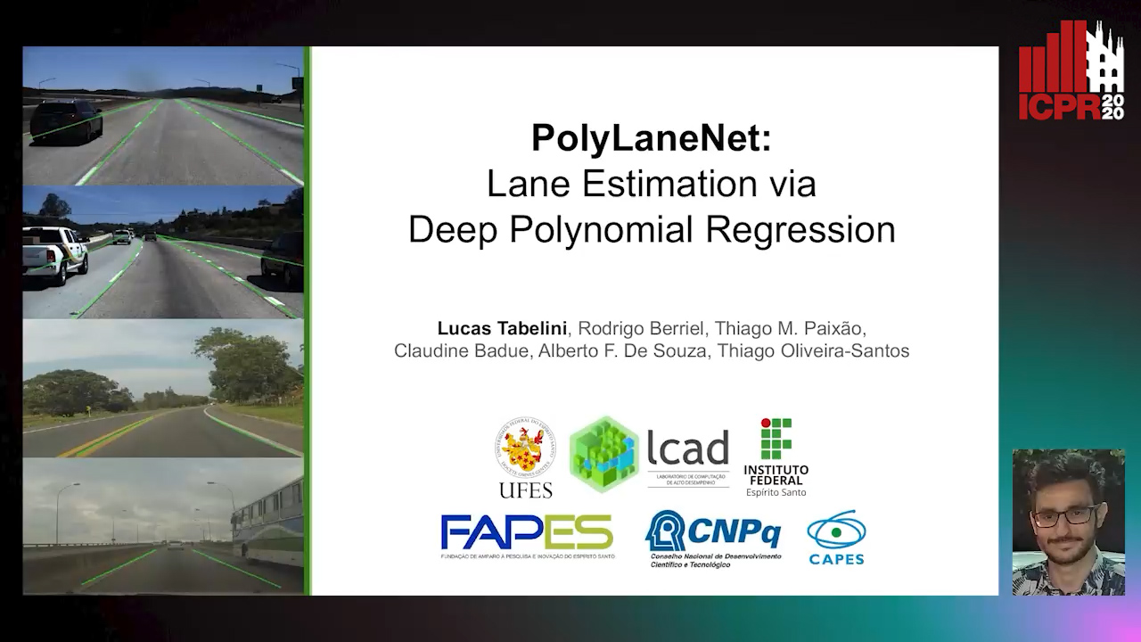
Auto-TLDR; Real-Time Lane Detection with Deep Polynomial Regression

Slides Poster Similar

One of the main factors that contributed to the large advances in autonomous driving is the advent of deep learning. For safer self-driving vehicles, one of the problems that has yet to be solved completely is lane detection. Since methods for this task have to work in real time (+30 FPS), they not only have to be effective (i.e., have high accuracy) but they also have to be efficient (i.e., fast). In this work, we present a novel method for lane detection that uses as input an image from a forward-looking camera mounted in the vehicle and outputs polynomials representing each lane marking in the image, via deep polynomial regression. The proposed method is shown to be competitive with existing state-of-the-art methods in the TuSimple dataset, while maintaining its efficiency (115 FPS). Additionally, extensive qualitative results on two additional public datasets are presented, alongside with limitations in the evaluation metrics used by recent works for lane detection. Finally, we provide source code and trained models that allow others to replicate all the results shown in this paper, which is surprisingly rare in state-of-the-art lane detection methods.

Visual Localization for Autonomous Driving: Mapping the Accurate Location in the City Maze

Dongfang Liu, Yiming Cui, Xiaolei Guo, Wei Ding, Baijian Yang, Yingjie Chen

Responsive image

Auto-TLDR; Feature Voting for Robust Visual Localization in Urban Settings

Slides Poster Similar

Accurate localization is a foundational capacity, required for autonomous vehicles to accomplish other tasks such as navigation or path planning. It is a common practice for vehicles to use GPS to acquire location information. However, the application of GPS can result in severe challenges when vehicles run within the inner city where different kinds of structures may shadow the GPS signal and lead to inaccurate location results. To address the localization challenges of urban settings, we propose a novel feature voting technique for visual localization. Different from the conventional front-view-based method, our approach employs views from three directions (front, left, and right) and thus significantly improves the robustness of location prediction. In our work, we craft the proposed feature voting method into three state-of-the-art visual localization networks and modify their architectures properly so that they can be applied for vehicular operation. Extensive field test results indicate that our approach can predict location robustly even in challenging inner-city settings. Our research sheds light on using the visual localization approach to help autonomous vehicles to find accurate location information in a city maze, within a desirable time constraint.

Anomaly Detection, Localization and Classification for Railway Inspection

Riccardo Gasparini, Andrea D'Eusanio, Guido Borghi, Stefano Pini, Giuseppe Scaglione, Simone Calderara, Eugenio Fedeli, Rita Cucchiara

Responsive image

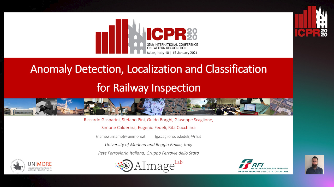
Auto-TLDR; Anomaly Detection and Localization using thermal images in the lowlight environment

Slides Similar

The ability to detect, localize and classify objects that are anomalies is a challenging task in the computer vision community. In this paper, we tackle these tasks developing a framework to automatically inspect the railway during the night. Specifically, it is able to predict the presence, the image coordinates and the class of obstacles. To deal with the lowlight environment, the framework is based on thermal images and consists of three different modules that address the problem of detecting anomalies, predicting their image coordinates and classifying them. Moreover, due to the absolute lack of publicly released datasets collected in the railway context for anomaly detection, we introduce a new multi-modal dataset, acquired from a rail drone, used to evaluate the proposed framework. Experimental results confirm the accuracy of the framework and its suitability, in terms of computational load, performance, and inference time, to be implemented on a self-powered inspection system.

A Fine-Grained Dataset and Its Efficient Semantic Segmentation for Unstructured Driving Scenarios

Kai Andreas Metzger, Peter Mortimer, Hans J "Joe" Wuensche

Responsive image

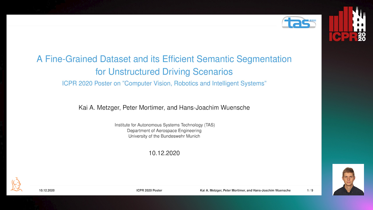
Auto-TLDR; TAS500: A Semantic Segmentation Dataset for Autonomous Driving in Unstructured Environments

Slides Poster Similar

Research in autonomous driving for unstructured environments suffers from a lack of semantically labeled datasets compared to its urban counterpart. Urban and unstructured outdoor environments are challenging due to the varying lighting and weather conditions during a day and across seasons. In this paper, we introduce TAS500, a novel semantic segmentation dataset for autonomous driving in unstructured environments. TAS500 offers fine-grained vegetation and terrain classes to learn drivable surfaces and natural obstacles in outdoor scenes effectively. We evaluate the performance of modern semantic segmentation models with an additional focus on their efficiency. Our experiments demonstrate the advantages of fine-grained semantic classes to improve the overall prediction accuracy, especially along the class boundaries. The dataset, code, and pretrained model are available online.

Manual-Label Free 3D Detection Via an Open-Source Simulator

Zhen Yang, Chi Zhang, Zhaoxiang Zhang, Huiming Guo

Responsive image

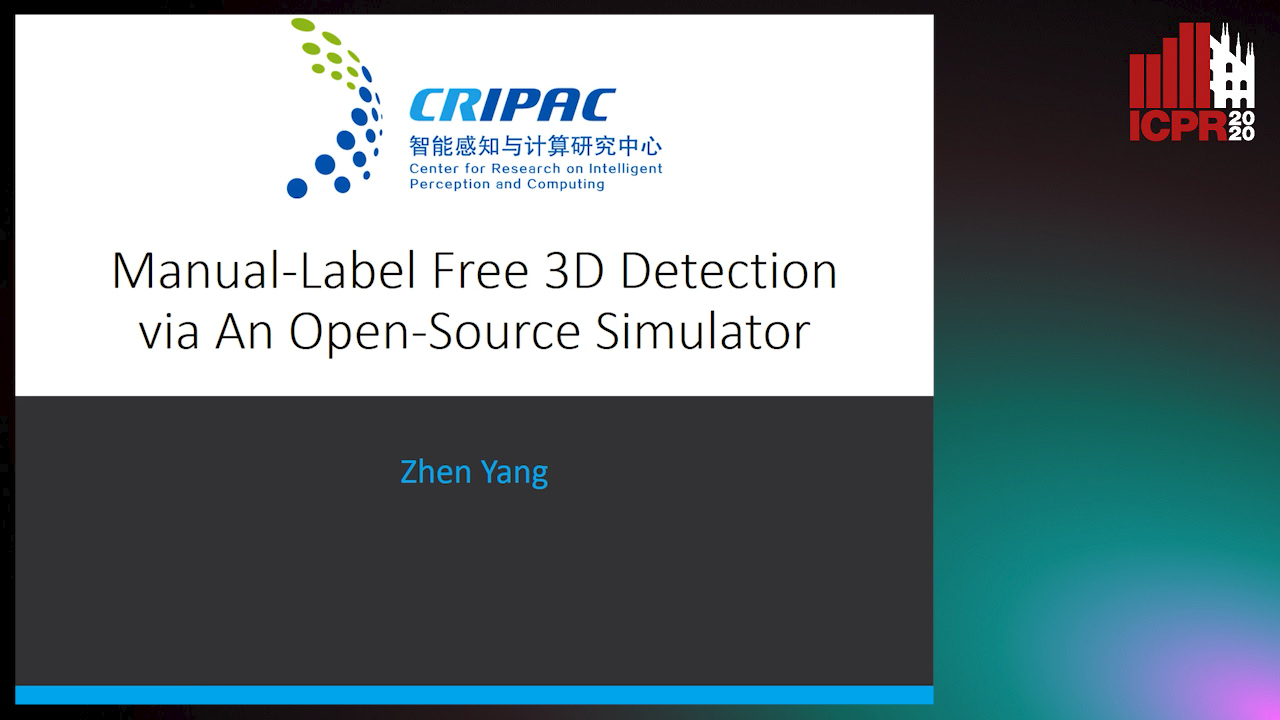
Auto-TLDR; DA-VoxelNet: A Novel Domain Adaptive VoxelNet for LIDAR-based 3D Object Detection

Slides Poster Similar

LiDAR based 3D object detectors typically need a large amount of detailed-labeled point cloud data for training, but these detailed labels are commonly expensive to acquire. In this paper, we propose a manual-label free 3D detection algorithm that leverages the CARLA simulator to generate a large amount of self-labeled training samples and introduces a novel Domain Adaptive VoxelNet (DA-VoxelNet) that can cross the distribution gap from the synthetic data to the real scenario. The self-labeled training samples are generated by a set of high quality 3D models embedded in a CARLA simulator and a proposed LiDAR-guided sampling algorithm. Then a DA-VoxelNet that integrates both a sample-level DA module and an anchor-level DA module is proposed to enable the detector trained by the synthetic data to adapt to real scenario. Experimental results show that the proposed unsupervised DA 3D detector on KITTI evaluation set can achieve 76.66% and 56.64% mAP on BEV mode and 3D mode respectively. The results reveal a promising perspective of training a LIDAR-based 3D detector without any hand-tagged label.

CARRADA Dataset: Camera and Automotive Radar with Range-Angle-Doppler Annotations

Arthur Ouaknine, Alasdair Newson, Julien Rebut, Florence Tupin, Patrick Pérez

Responsive image

Auto-TLDR; CARRADA: A dataset of synchronized camera and radar recordings with range-angle-Doppler annotations for autonomous driving

Slides Poster Similar

High quality perception is essential for autonomous driving (AD) systems. To reach the accuracy and robustness that are required by such systems, several types of sensors must be combined. Currently, mostly cameras and laser scanners (lidar) are deployed to build a representation of the world around the vehicle. While radar sensors have been used for a long time in the automotive industry, they are still under-used for AD despite their appealing characteristics (notably, their ability to measure the relative speed of obstacles and to operate even in adverse weather conditions). To a large extent, this situation is due to the relative lack of automotive datasets with real radar signals that are both raw and annotated. In this work, we introduce CARRADA, a dataset of synchronized camera and radar recordings with range-angle-Doppler annotations. We also present a semi-automatic annotation approach, which was used to annotate the dataset, and a radar semantic segmentation baseline, which we evaluate on several metrics. Both our code and dataset will be released.

IPT: A Dataset for Identity Preserved Tracking in Closed Domains

Thomas Heitzinger, Martin Kampel

Responsive image

Auto-TLDR; Identity Preserved Tracking Using Depth Data for Privacy and Privacy

Slides Poster Similar

We present a public dataset for Identity Preserved Tracking (IPT) consisting of sequences of depth data recorded using an Orbbec Astra depth sensor. The dataset features sequences in ten different locations with a high amount of background variation and is designed to be applicable to a wide range of tasks. Its labeling is versatile, allowing for tracking in either 3d space or image coordinates. Next to frame-by-frame 3d and inferred bounding box labeling we provide supplementary annotation of camera poses and room layouts, split in multiple semantically distinct categories. Intended use-cases are applications where both a high level understanding of scene understanding and privacy are central points of consideration, such as active and assisted living (AAL), security and industrial safety. Compared to similar public datasets IPT distinguishes itself with its sequential data format, 3d instance labeling and room layout annotation. We present baseline object detection results in image coordinates using a YOLOv3 network architecture and implement a background model suitable for online tracking applications to increase detection accuracy. Additionally we propose a novel volumetric non-maximum suppression (V-NMS) approach, taking advantage of known room geometry. Last we provide baseline person tracking results utilizing Multiple Object Tracking Challenge (MOTChallenge) evaluation metrics of the CVPR19 benchmark.

Map-Based Temporally Consistent Geolocalization through Learning Motion Trajectories

Bing Zha, Alper Yilmaz

Responsive image

Auto-TLDR; Exploiting Motion Trajectories for Geolocalization of Object on Topological Map using Recurrent Neural Network

Slides Poster Similar

In this paper, we propose a novel trajectory learning method that exploits motion trajectories on topological map using recurrent neural network for temporally consistent geolocalization of object. Inspired by human's ability to both be aware of distance and direction of self-motion in navigation, our trajectory learning method learns a pattern representation of trajectories encoded as a sequence of distances and turning angles to assist self-localization. We pose the learning process as a conditional sequence prediction problem in which each output locates the object on a traversable edge in a map. Considering the prediction sequence ought to be topologically connected in the graph-structured map, we adopt two different hypotheses generation and elimination strategies to eliminate disconnected sequence prediction. We demonstrate our approach on the KITTI stereo visual odometry dataset which is a city-scale environment. The key benefits of our approach to geolocalization are that 1) we take advantage of powerful sequence modeling ability of recurrent neural network and its robustness to noisy input, 2) only require a map in the form of a graph and 3) simply use an affordable sensor that generates motion trajectory. The experiments show that the motion trajectories can be learned by training an recurrent neural network, and temporally consistent geolocation can be predicted with both of the proposed strategies.

Utilising Visual Attention Cues for Vehicle Detection and Tracking

Feiyan Hu, Venkatesh Gurram Munirathnam, Noel E O'Connor, Alan Smeaton, Suzanne Little

Responsive image

Auto-TLDR; Visual Attention for Object Detection and Tracking in Driver-Assistance Systems

Slides Poster Similar

Advanced Driver-Assistance Systems (ADAS) have been attracting attention from many researchers. Vision based sensors are the closest way to emulate human driver visual behavior while driving. In this paper, we explore possible ways to use visual attention (saliency) for object detection and tracking. We investigate: 1) How a visual attention map such as a subjectness attention or saliency map and an objectness attention map can facilitate region proposal generation in a 2-stage object detector; 2) How a visual attention map can be used for tracking multiple objects. We propose a neural network that can simultaneously detect objects as and generate objectness and subjectness maps to save computational power. We further exploit the visual attention map during tracking using a sequential Monte Carlo probability hypothesis density (PHD) filter. The experiments are conducted on KITTI and DETRAC datasets. The use of visual attention and hierarchical features has shown a considerable improvement of≈8% in object detection which effectively increased tracking performance by≈4% on KITTI dataset.

Derivation of Geometrically and Semantically Annotated UAV Datasets at Large Scales from 3D City Models

Sidi Wu, Lukas Liebel, Marco Körner

Responsive image

Auto-TLDR; Large-Scale Dataset of Synthetic UAV Imagery for Geometric and Semantic Annotation

Slides Poster Similar

While in high demand for the development of deep learning approaches, extensive datasets of annotated UAV imagery are still scarce today. Manual annotation, however, is time-consuming and, thus, has limited the potential for creating large-scale datasets. We tackle this challenge by presenting a procedure for the automatic creation of simulated UAV image sequences in urban areas and pixel-level annotations from publicly available data sources. We synthesize photo-realistic UAV imagery from Goole Earth Studio and derive annotations from an open CityGML model that not only provides geometric but also semantic information. The first dataset we exemplarily created using our approach contains 144000 images of Berlin, Germany, with four types of annotations, namely semantic labels as well as depth, surface normals, and edge maps. In the future, a complete pipeline regarding all the technical problems will be provided, together with more accurate models to refine some of the empirical settings currently, to automatically generate a large-scale dataset with reliable ground-truth annotations over the whole city of Berlin. The dataset, as well as the source code, will be published by then. Different methods will also be facilitated to test the usability of the dataset. We believe our dataset can be used for, and not limited to, tasks like pose estimation, geo-localization, monocular depth estimation, edge detection, building/surface classification, and plane segmentation. A potential research pipeline for geo-localization based on the synthetic dataset is provided.

EAGLE: Large-Scale Vehicle Detection Dataset in Real-World Scenarios Using Aerial Imagery

Seyed Majid Azimi, Reza Bahmanyar, Corentin Henry, Kurz Franz

Responsive image

Auto-TLDR; EAGLE: A Large-Scale Dataset for Multi-class Vehicle Detection with Object Orientation Information in Airborne Imagery

Slides Similar

Multi-class vehicle detection from airborne imagery with orientation estimation is an important task in the near and remote vision domains with applications in traffic monitoring and disaster management. In the last decade, we have witnessed significant progress in object detection in ground imagery, but it is still in its infancy in airborne imagery, mostly due to the scarcity of diverse and large-scale datasets. Despite being a useful tool for different applications, current airborne datasets only partially reflect the challenges of real-world scenarios. To address this issue, we introduce EAGLE (oriEnted object detection using Aerial imaGery in real-worLd scEnarios), a large-scale dataset for multi-class vehicle detection with object orientation information in aerial imagery. It features high-resolution aerial images composed of different real-world situations with a wide variety of camera sensor, resolution, flight altitude, weather, illumination, haze, shadow, time, city, country, occlusion, and camera angle. The annotation was done by airborne imagery experts with small- and large-vehicle classes. EAGLE contains 215,986 instances annotated with oriented bounding boxes defined by four points and orientation, making it by far the largest dataset to date in this task. It also supports researches on the haze and shadow removal as well as super-resolution and in-painting applications. We define three tasks: detection by (1) horizontal bounding boxes, (2) rotated bounding boxes, and (3) oriented bounding boxes. We carried out several experiments to evaluate several state-of-the-art methods in object detection on our dataset to form a baseline. Experiments show that the EAGLE dataset accurately reflects real-world situations and correspondingly challenging applications. The dataset will be made publicly available.

Benchmarking Cameras for OpenVSLAM Indoors

Kevin Chappellet, Guillaume Caron, Fumio Kanehiro, Ken Sakurada, Abderrahmane Kheddar

Responsive image

Auto-TLDR; OpenVSLAM: Benchmarking Camera Types for Visual Simultaneous Localization and Mapping

Slides Poster Similar

In this paper we benchmark different types of cameras and evaluate their performance in terms of reliable localization reliability and precision in Visual Simultaneous Localization and Mapping (vSLAM). Such benchmarking is merely found for visual odometry, but never for vSLAM. Existing studies usually compare several algorithms for a given camera. %This work is the first to handle the dual of the latter, i.e. comparing several cameras for a given SLAM algorithm. The evaluation methodology we propose is applied to the recent OpenVSLAM framework. The latter is versatile enough to natively deal with perspective, fisheye, 360 cameras in a monocular or stereoscopic setup, an in RGB or RGB-D modalities. Results in various sequences containing light variation and scenery modifications in the scene assess quantitatively the maximum localization rate for 360 vision. In the contrary, RGB-D vision shows the lowest localization rate, but highest precision when localization is possible. Stereo-fisheye trades-off with localization rates and precision between 360 vision and RGB-D vision. The dataset with ground truth will be made available in open access to allow evaluating other/future vSLAM algorithms with respect to these camera types.

PointDrop: Improving Object Detection from Sparse Point Clouds Via Adversarial Data Augmentation

Wenxin Ma, Jian Chen, Qing Du, Wei Jia

Responsive image

Auto-TLDR; PointDrop: Improving Robust 3D Object Detection to Sparse Point Clouds

Slides Poster Similar

Current 3D object detection methods achieve accurate and efficient results on the standard point cloud dataset. However, in real-world applications, due to the expensive cost of obtaining the annotated 3D object detection data, we expect to directly apply the model trained on the standard dataset to real-world scenarios. This strategy may fail because the point cloud samples obtained in the real-world scenarios may be much sparser due to various reasons (occlusion, low reflectivity of objects and fewer laser beams) and existing methods do not consider the limitations of their models on sparse point clouds. To improve the robustness of an object detector to sparser point clouds, we propose PointDrop, which learns to drop the features of some key points in the point clouds to generate challenging sparse samples for data augmentation. Moreover, PointDrop is able to adjust the difficulty of the generated samples based on the capacity of the detector and thus progressively improve the performance of the detector. We create two sparse point clouds datasets from the KITTI dataset to evaluate our method, and the experimental results show that PointDrop significantly improves the robustness of the detector to sparse point clouds.

Semantic Segmentation for Pedestrian Detection from Motion in Temporal Domain

Guo Cheng, Jiang Yu Zheng

Responsive image

Auto-TLDR; Motion Profile: Recognizing Pedestrians along with their Motion Directions in a Temporal Way

Slides Poster Similar

In autonomous driving, state-of-the-art methods detect pedestrian through appearance in 2-D spatial images. However, these approaches are typically time-consuming because of the complexity of algorithms to cope with large variations in shape, pose, action, and illumination. They also fall short of capturing temporal continuity in motion trace. In a completely different approach, this work recognizes pedestrians along with their motion directions in a temporal way. By projecting a driving video to a 2-D temporal image called Motion Profile (MP), we can robustly distinguish pedestrian in motion and standing-still against smooth background motion. To ensure non-redundant data processing of deep network on a compact motion profile further, a novel temporal-shift memory (TSM) model is developed to perform deep learning of sequential input in linear processing time. In experiments containing various pedestrian motion from sensors such as video and LiDAR, we demonstrate that, with the data size around 3/720th of video volume, this motion-based method can reach the detecting rate of pedestrians at 90% in near and mid-range on the road. With a super-fast processing speed and good accuracy, this method is promising for intelligent vehicles.

Multi-View Object Detection Using Epipolar Constraints within Cluttered X-Ray Security Imagery

Brian Kostadinov Shalon Isaac-Medina, Chris G. Willcocks, Toby Breckon

Responsive image

Auto-TLDR; Exploiting Epipolar Constraints for Multi-View Object Detection in X-ray Security Images

Slides Poster Similar

Automatic detection for threat object items is an increasing emerging area of future application in X-ray security imagery. Although modern X-ray security scanners can provide two or more views, the integration of such object detectors across the views has not been widely explored with rigour. Therefore, we investigate the application of geometric constraints using the epipolar nature of multi-view imagery to improve object detection performance. Furthermore, we assume that images come from uncalibrated views, such that a method to estimate the fundamental matrix using ground truth bounding box centroids from multiple view object detection labels is proposed. In addition, detections are given a score based on its similarity with respect to the distribution of the error of the epipolar estimation. This score is used as confidence weights for merging duplicated predictions using non-maximum suppression. Using a standard object detector (YOLOv3), our technique increases the average precision of detection by 2.8% on a dataset composed of firearms, laptops, knives and cameras. These results indicate that the integration of images at different views significantly improves the detection performance of threat items of cluttered X-ray security images.

Image Sequence Based Cyclist Action Recognition Using Multi-Stream 3D Convolution

Stefan Zernetsch, Steven Schreck, Viktor Kress, Konrad Doll, Bernhard Sick

Responsive image

Auto-TLDR; 3D-ConvNet: A Multi-stream 3D Convolutional Neural Network for Detecting Cyclists in Real World Traffic Situations

Slides Poster Similar

In this article, we present an approach to detect basic movements of cyclists in real world traffic situations based on image sequences, optical flow (OF) sequences, and past positions using a multi-stream 3D convolutional neural network (3D-ConvNet) architecture. To resolve occlusions of cyclists by other traffic participants or road structures, we use a wide angle stereo camera system mounted at a heavily frequented public intersection. We created a large dataset consisting of 1,639 video sequences containing cyclists, recorded in real world traffic, resulting in over 1.1 million samples. Through modeling the cyclists' behavior by a state machine of basic cyclist movements, our approach takes every situation into account and is not limited to certain scenarios. We compare our method to an approach solely based on position sequences. Both methods are evaluated taking into account frame wise and scene wise classification results of basic movements, and detection times of basic movement transitions, where our approach outperforms the position based approach by producing more reliable detections with shorter detection times. Our code and parts of our dataset are made publicly available.

Forground-Guided Vehicle Perception Framework

Kun Tian, Tong Zhou, Shiming Xiang, Chunhong Pan

Responsive image

Auto-TLDR; A foreground segmentation branch for vehicle detection

Slides Poster Similar

As the basis of advanced visual tasks such as vehicle tracking and traffic flow analysis, vehicle detection needs to accurately predict the position and category of vehicle objects. In the past decade, deep learning based methods have made great progress. However, we also notice that some existing cases are not studied thoroughly. First, false positive on the background regions is one of the critical problems. Second, most of the previous approaches only optimize a single vehicle detection model, ignoring the relationship between different visual perception tasks. In response to the above two findings, we introduce a foreground segmentation branch for the first time, which can predict the pixel level of vehicles in advance. Furthermore, two attention modules are designed to guide the work of the detection branch. The proposed method can be easily grafted into the one-stage and two-stage detection framework. We evaluate the effectiveness of our model on LSVH, a dataset with large variations in vehicle scales, and achieve the state-of-the-art detection accuracy.

A Two-Step Approach to Lidar-Camera Calibration

Yingna Su, Yaqing Ding, Jian Yang, Hui Kong

Responsive image

Auto-TLDR; Closed-Form Calibration of Lidar-camera System for Ego-motion Estimation and Scene Understanding

Slides Poster Similar

Autonomous vehicles and robots are typically equipped with Lidar and camera. Hence, calibrating the Lidar-camera system is of extreme importance for ego-motion estimation and scene understanding. In this paper, we propose a two-step approach (coarse + fine) for the external calibration between a camera and a multiple-line Lidar. First, a new closed-form solution is proposed to obtain the initial calibration parameters. We compare our solution with the state-of-the-art SVD-based algorithm, and show the benefits of both the efficiency and stability. With the initial calibration parameters, the ICP-based calibration framework is used to register the point clouds which extracted from the camera and Lidar coordinate frames, respectively. Our method has been applied to two Lidar-camera systems: an HDL-64E Lidar-camera system, and a VLP-16 Lidar-camera system. Experimental results demonstrate that our method achieves promising performance and higher accuracy than two open-source methods.

Visual Object Tracking in Drone Images with Deep Reinforcement Learning

Derya Gözen, Sedat Ozer

Responsive image

Auto-TLDR; A Deep Reinforcement Learning based Single Object Tracker for Drone Applications

Slides Poster Similar

There is an increasing demand on utilizing camera equipped drones and their applications in many domains varying from agriculture to entertainment and from sports events to surveillance. In such drone applications, an essential and a common task is tracking an object of interest visually. Drone (or UAV) images have different properties when compared to the ground taken (natural) images and those differences introduce additional complexities to the existing object trackers to be directly applied on drone applications. Some important differences among those complexities include (i) smaller object sizes to be tracked and (ii) different orientations and viewing angles yielding different texture and features to be observed. Therefore, new algorithms trained on drone images are needed for the drone-based applications. In this paper, we introduce a deep reinforcement learning (RL) based single object tracker that tracks an object of interest in drone images by estimating a series of actions to find the location of the object in the next frame. This is the first work introducing a single object tracker using a deep RL-based technique for drone images. Our proposed solution introduces a novel reward function that aims to reduce the total number of actions taken to estimate the object's location in the next frame and also introduces a different backbone network to be used on low resolution images. Additionally, we introduce a set of new actions into the action library to better deal with the above-mentioned complexities. We compare our proposed solutions to a state of the art tracking algorithm from the recent literature and demonstrate up to 3.87\% improvement in precision and 3.6\% improvement in IoU values on the VisDrone2019 dataset. We also provide additional results on OTB-100 dataset and show up to 3.15\% improvement in precision on the OTB-100 dataset when compared to the same previous state of the art algorithm. Lastly, we analyze the ability to handle some of the challenges faced during tracking, including but not limited to occlusion, deformation, and scale variation for our proposed solutions.

AV-SLAM: Autonomous Vehicle SLAM with Gravity Direction Initialization

Kaan Yilmaz, Baris Suslu, Sohini Roychowdhury, L. Srikar Muppirisetty

Responsive image

Auto-TLDR; VI-SLAM with AGI: A combination of three SLAM algorithms for autonomous vehicles

Slides Poster Similar

Simultaneous localization and mapping (SLAM) algorithms that are aimed at autonomous vehicles (AVs) are required to utilize sensor redundancies specific to AVs and enable accurate, fast and repeatable estimations of pose and path trajectories. In this work, we present a combination of three SLAM algorithms that utilize a different subset of available sensors such as inertial measurement unit (IMU), a gray-scale mono-camera, and a Lidar. Also, we propose a novel acceleration-based gravity direction initialization (AGI) method for the visual-inertial SLAM algorithm. We analyze the SLAM algorithms and initialization methods for pose estimation accuracy, speed of convergence and repeatability on the KITTI odometry sequences. The proposed VI-SLAM with AGI method achieves relative pose errors less than 2\%, convergence in half a minute or less and convergence time variability less than 3s, which makes it preferable for AVs.

Future Urban Scenes Generation through Vehicles Synthesis

Alessandro Simoni, Luca Bergamini, Andrea Palazzi, Simone Calderara, Rita Cucchiara

Responsive image

Auto-TLDR; Predicting the Future of an Urban Scene with a Novel View Synthesis Paradigm

Slides Poster Similar

In this work we propose a deep learning pipeline to predict the visual future appearance of an urban scene. Despite recent advances, generating the entire scene in an end-to-end fashion is still far from being achieved. Instead, here we follow a two stages approach, where interpretable information is included in the loop and each actor is modelled independently. We leverage a per-object novel view synthesis paradigm; i.e. generating a synthetic representation of an object undergoing a geometrical roto-translation in the 3D space. Our model can be easily conditioned with constraints (e.g. input trajectories) provided by state-of-the-art tracking methods or by the user itself. This allows us to generate a set of diverse realistic futures starting from the same input in a multi-modal fashion. We visually and quantitatively show the superiority of this approach over traditional end-to-end scene-generation methods on CityFlow, a challenging real world dataset.

FeatureNMS: Non-Maximum Suppression by Learning Feature Embeddings

Niels Ole Salscheider

Responsive image

Auto-TLDR; FeatureNMS: Non-Maximum Suppression for Multiple Object Detection

Slides Poster Similar

Most state of the art object detectors output multiple detections per object. The duplicates are removed in a post-processing step called Non-Maximum Suppression. Classical Non-Maximum Suppression has shortcomings in scenes that contain objects with high overlap: The idea of this heuristic is that a high bounding box overlap corresponds to a high probability of having a duplicate. We propose FeatureNMS to solve this problem. FeatureNMS recognizes duplicates not only based on the intersection over union between bounding boxes, but also based on the difference of feature vectors. These feature vectors can encode more information like visual appearance. Our approach outperforms classical NMS and derived approaches and achieves state of the art performance.

Two-Stage Adaptive Object Scene Flow Using Hybrid CNN-CRF Model

Congcong Li, Haoyu Ma, Qingmin Liao

Responsive image

Auto-TLDR; Adaptive object scene flow estimation using a hybrid CNN-CRF model and adaptive iteration

Slides Poster Similar

Scene flow estimation based on stereo sequences is a comprehensive task relevant to disparity and optical flow. Some existing methods are time-consuming and often fail in the presence of reflective surfaces. In this paper, we propose a two-stage adaptive object scene flow estimation method using a hybrid CNN-CRF model (ACOSF), which benefits from high-quality features and the structured modelling capability. Meanwhile, in order to balance the computational efficiency and accuracy, we employ adaptive iteration for energy function optimization, which is flexible and efficient for various scenes. Besides, we utilize high-quality pixel selection to reduce the computation time with only a slight decrease in accuracy. Our method achieves competitive results with the state-of-the-art, which ranks second on the challenging KITTI 2015 scene flow benchmark.

Story Comparison for Estimating Field of View Overlap in a Video Collection

Thierry Malon, Sylvie Chambon, Alain Crouzil, Vincent Charvillat

Responsive image

Auto-TLDR; Finding Videos with Overlapping Fields of View Using Video Data

Slides Similar

Determining the links between large amounts of video data with no prior knowledge of the camera positions is a hard task to automate. From a collection of videos acquired from static cameras simultaneously, we propose a method for finding groups of videos with overlapping fields of view. Each video is first processed individually: at regular time steps, objects are detected and are assigned a category and an appearance descriptor. Next, the video is split into cells at different resolutions and we assign to each cell its story: it consists of the list of objects detected in the cell over time. Once the stories are established for each video, the links between cells of different videos are determined by comparing their stories: two cells are linked if they show simultaneous detections of objects of the same category with similar appearances. Pairs of videos with overlapping fields of view are identified using these links between cells. A link graph is finally returned, in which each node represents a video, and the edges indicate pairs of overlapping videos. The approach is evaluated on a set of 63 real videos from both public datasets and live surveillance videos, as well as on 84 synthetic videos, and shows promising results.

Camera Calibration Using Parallel Line Segments

Gaku Nakano

Responsive image

Auto-TLDR; Closed-Form Calibration of Surveillance Cameras using Parallel 3D Line Segment Projections

Slides Poster Similar

This paper proposes a camera calibration method suitable for surveillance cameras using the image projection of parallel 3D line segments of the same length. We assume that vertical line segments are perpendicular to the ground plane and their bottom end-points are on the ground plane. Under this assumption, the camera parameters can be directly solved by at least two line segments without estimating vanishing points. Extending the minimal solution, we derive a closed-form solution to the least squares case with more than two line segments. Lens distortion is jointly optimized in bundle adjustment. Synthetic data evaluation shows that the best depression angle of a camera is around 50 degrees. In real data evaluation, we use body joints of pedestrians as vertical line segments. The experimental results on publicly available datasets show that the proposed method with a human pose detector can correctly calibrate wide-angle cameras including radial distortion.

Iterative Bounding Box Annotation for Object Detection

Bishwo Adhikari, Heikki Juhani Huttunen

Responsive image

Auto-TLDR; Semi-Automatic Bounding Box Annotation for Object Detection in Digital Images

Slides Poster Similar

Manual annotation of bounding boxes for object detection in digital images is tedious, and time and resource consuming. In this paper, we propose a semi-automatic method for efficient bounding box annotation. The method trains the object detector iteratively on small batches of labeled images and learns to propose bounding boxes for the next batch, after which the human annotator only needs to correct possible errors. We propose an experimental setup for simulating the human actions and use it for comparing different iteration strategies, such as the order in which the data is presented to the annotator. We experiment on our method with three datasets and show that it can reduce the human annotation effort significantly, saving up to 75% of total manual annotation work.

MagnifierNet: Learning Efficient Small-Scale Pedestrian Detector towards Multiple Dense Regions

Qi Cheng, Mingqin Chen, Yingjie Wu, Fei Chen, Shiping Lin

Responsive image

Auto-TLDR; MagnifierNet: A Simple but Effective Small-Scale Pedestrian Detection Towards Multiple Dense Regions

Slides Poster Similar

Despite the success of pedestrian detection, there is still a significant gap in the performance of the detection of pedestrians at different scales. Detecting small-scale pedestrians is extremely challenging due to the low resolution of their convolution features which is essential for downstream classifiers. To address this issue, we observed pedestrian datasets and found that pedestrians often gather together in crowded public places. Then we propose MagnifierNet, a simple but effective small-scale pedestrian detector towards multiple dense regions. MagnifierNet uses our proposed sweep-line based grouping algorithm to find dense regions based on the number of pedestrians in the grouped region. And we adopt a new definition of small-scale pedestrians through grid search and KL-divergence. Besides, our grouping method can also be used as a new strategy for pedestrian data augmentation. The ablation study demonstrates that MagnifierNet improves the representation of small-scale pedestrians. We validate the effectiveness of MagnifierNet on CityPersons and KITTI datasets. Experimental results show that MagnifierNet achieves the best small-scale pedestrian detection performance on CityPersons benchmark without any external data, and also achieves competitive performance for detecting small-scale pedestrians on KITTI dataset without bells and whistles.